
2019 Map of Bisonte
USGS Topo · Published 2019About this map
Bisonte serves as a primary marker in this corner of Baca County, where the high plains of southeastern Colorado meet a managed network of public lands. Much of the southern and central terrain is defined by the Comanche National Grassland, a landscape etched by ephemeral watercourses such as Sand Arroyo Cr and Dry Cr. The map reveals a strictly organized grid of county roads, including Co RD 26 and Co RD BB, which delineate the section lines of this agricultural and grazing region. Evidence of the local topography is found in features like Lone Rock Draw, providing a detailed look at the drainage patterns that characterize this portion of the Great Plains. The sparse distribution of named points highlights the vastness of the grassland units, punctuated only by administrative and surveying boundaries.
Find a feature on this map
36 named features on this map. Tap any name to fly to it.
Don’t see what you’re looking for? This feature index may not catch every label — zoom into the map to look around manually.
Map Details
Editions of this 2019 Bisonte Map
This is the sole edition of this map. No revisions or reprints were ever made.
Other maps of this area

1891 · Springfield
USGS Topo · 1:125,000

1892 · Vilas
USGS Topo · 1:125,000

1893 · Springfield
USGS Topo · 1:125,000

1955 · La Junta
USGS Topo · 1:250,000

1958 · La Junta
USGS Topo · 1:250,000

1968 · La Junta
USGS Topo · 1:250,000

1978 · Springfield SW
USGS Topo · 1:24,000

1978 · Campo NE
USGS Topo · 1:24,000
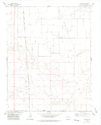
1978 · Bisonte
USGS Topo · 1:24,000
1978 · Vilas North
USGS Topo · 1:24,000