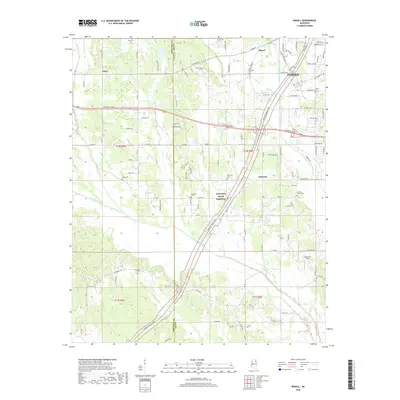
2018 Map of Bissell
USGS Topo · Published 2018About this map
Tupelo anchors the eastern edge of this landscape, where the modern developments of Lee County meet the rural traditions of the Pontotoc County line. The map reveals a dense network of small communities and family burial grounds, including the New Zion Cem and Old Coffee Cem, which offer significant value for genealogical research in this portion of Mississippi. The modern transit corridors of the Natchez Trace Parkway and the BNSF Railway bisect the terrain, cutting through a landscape drained by the winding courses of Chiwapa Creek and Coonewah Creek. This survey details the transition from the municipal boundaries of the city toward the agricultural settlements of Bissell, Furrs, and Palmetto, preserving the exact placement of local landmarks like Spearman Field and numerous named family cemeteries.
Find a feature on this map
155 named features on this map. Tap any name to fly to it.
Don’t see what you’re looking for? This feature index may not catch every label — zoom into the map to look around manually.
Map Details
Editions of this 2018 Bissell Map
This is the sole edition of this map. No revisions or reprints were ever made.
Other maps of this area

1921 · Tupelo
USGS Topo · 1:48,000

1923 · Tupelo
USGS Topo · 1:62,500

1955 · Sherman
USGS Topo · 1:62,500

1956 · Tupelo
USGS Topo · 1:250,000

1958 · Tupelo
USGS Topo · 1:250,000

1966 · Shannon
USGS Topo · 1:24,000

1966 · Troy NW
USGS Topo · 1:24,000

1966 · Troy SE
USGS Topo · 1:24,000

1966 · Bissell
USGS Topo · 1:24,000

1966 · Verona
USGS Topo · 1:24,000