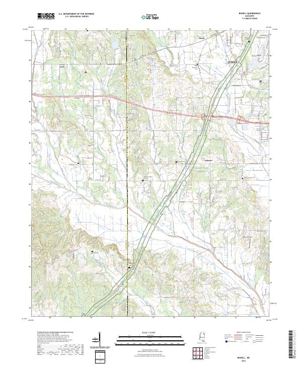
2024 Map of Bissell
USGS Topo · Published 2024About this map
Tupelo anchors the northeastern corner of this Lee County landscape, where urban streets like Cliff Gookin Blvd and W Main St give way to the sprawling rural reaches of western Mississippi. The Natchez Trace Parkway cuts a diagonal swath across the terrain, passing through the community of Palmetto and providing a modern corridor through a region defined by its watercourses. Streams such as Chiwapa Creek, Tubbalubba Creek, and Coonewah Creek drain the lowlands, shaping the agricultural patterns of the surrounding countryside.
Find a feature on this map
118 named features on this map. Tap any name to fly to it.
Don’t see what you’re looking for? This feature index may not catch every label — zoom into the map to look around manually.
Map Details
Editions of this 2024 Bissell Map
This is the sole edition of this map. No revisions or reprints were ever made.
Other maps of this area

1921 · Tupelo
USGS Topo · 1:48,000

1923 · Tupelo
USGS Topo · 1:62,500

1955 · Sherman
USGS Topo · 1:62,500

1956 · Tupelo
USGS Topo · 1:250,000

1958 · Tupelo
USGS Topo · 1:250,000

1966 · Shannon
USGS Topo · 1:24,000

1966 · Troy NW
USGS Topo · 1:24,000

1966 · Troy SE
USGS Topo · 1:24,000

1966 · Bissell
USGS Topo · 1:24,000

1966 · Verona
USGS Topo · 1:24,000