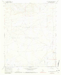
1966 Map of Bisti Trading Post
USGS Topo · Published 1981About this map
The Navajo Indian Reservation covers the vast majority of this arid landscape, characterized by the intricate drainage systems of Hunter Wash. The area is sparsely developed, with the Bisti Trading Post serving as a primary point of human activity and commerce in the southeastern corner. An industrial footprint is present in the form of a long Pipeline that traverses the reservation, reflecting the energy development common in the San Juan Basin during the mid-1960s. The topography is marked by a network of dry washes and small Mines and Mines in the southern reaches, suggesting localized mineral exploration or extraction activities during this period. The survey provides a clear view of the road network and land divisions established by the Bureau of Indian Affairs Survey.
Find a feature on this map
8 named features on this map. Tap any name to fly to it.
Don’t see what you’re looking for? This feature index may not catch every label — zoom into the map to look around manually.
Map Details
Editions of this 1966 Bisti Trading Post Map
2 editions found
Other maps of this area

1889 · Chaco
USGS Topo · 1:250,000

1892 · Chaco
USGS Topo · 1:250,000

1927 · Sulphur Spring
USGS Topo · 1:96,000

1928 · Kirtland
USGS Topo · 1:125,000

1932 · Kirtland
USGS Topo · 1:125,000

1954 · Shiprock
USGS Topo · 1:250,000

1958 · Shiprock
USGS Topo · 1:250,000

1959 · Shiprock
USGS Topo · 1:250,000
1966 · Tanner Lake
USGS Topo · 1:24,000
1966 · Alamo Mesa West
USGS Topo · 1:24,000
Featured Places
- Shiprock Agency
- Eastern Navajo Agency, NM
- Bisti, Eastern Navajo Agency
- San Juan County, NM
- United States