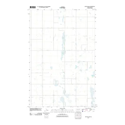
2011 Map of Bitter Lake
USGS Topo · Published 2011About this map
Bitter Lake and its elongated basin define the central landscape of this rural portion of Nelson County. In a region dominated by agricultural field patterns and an orderly section-line road network, the topography is punctuated by numerous small water bodies and seasonal wetlands. Horseshoe Lake sits near the eastern boundary, while the southernmost reaches of the quadrangle feature Twin Lakes. This 2011 survey reflects the enduring Jeffersonian grid system of the Great Plains, where primary thoroughfares like County Rd 15 and various township roads, such as 37th St NE and 112th Ave NE, provide the only consistent markers of human organization across the prairie.
Find a feature on this map
18 named features on this map. Tap any name to fly to it.
Don’t see what you’re looking for? This feature index may not catch every label — zoom into the map to look around manually.
Map Details
Editions of this 2011 Bitter Lake Map
This is the sole edition of this map. No revisions or reprints were ever made.
Other maps of this area

1930 · Pekin
USGS Topo · 1:62,500

1942 · McVille
USGS Topo · 1:62,500

1951 · Pekin NE
USGS Topo · 1:24,000

1951 · Pekin
USGS Topo · 1:24,000

1951 · Pekin
USGS Topo · 1:62,500

1952 · New Rockford
USGS Topo · 1:250,000

1953 · Devils Lake
USGS Topo · 1:250,000

1956 · New Rockford
USGS Topo · 1:250,000

1956 · Devils Lake
USGS Topo · 1:250,000
1961 · McVille
USGS Topo · 1:24,000