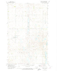
1971 Map of Bitter Lake
USGS Topo · Published 1974About this map
Bitter Lake dominates the central portion of this Nelson County landscape, characterized by the intricate drainage and pothole wetlands of the Red River Valley’s western reaches. The early 1970s terrain reflects a heavy emphasis on conservation, marked by the extensive National Waterfowl Production Area which occupies much of the western half of the quadrangle. This area was part of a critical environmental effort by the Department of the Interior to preserve the essential prairie pothole habitat for migrating birds. Bordered by the civil townships of Williams, Michigan City, Central, and Melvin, the map provides a look at the rural section lines and local industry, such as a Gravel Pit, interspersed with water bodies like Horseshoe Lake and Twin Lakes.
Find a feature on this map
9 named features on this map. Tap any name to fly to it.
Don’t see what you’re looking for? This feature index may not catch every label — zoom into the map to look around manually.
Map Details
Editions of this 1971 Bitter Lake Map
This is the sole edition of this map. No revisions or reprints were ever made.
Other maps of this area

1930 · Pekin
USGS Topo · 1:62,500

1942 · McVille
USGS Topo · 1:62,500

1951 · Pekin NE
USGS Topo · 1:24,000

1951 · Pekin
USGS Topo · 1:24,000

1951 · Pekin
USGS Topo · 1:62,500

1952 · New Rockford
USGS Topo · 1:250,000

1953 · Devils Lake
USGS Topo · 1:250,000

1956 · New Rockford
USGS Topo · 1:250,000

1956 · Devils Lake
USGS Topo · 1:250,000
1961 · McVille
USGS Topo · 1:24,000