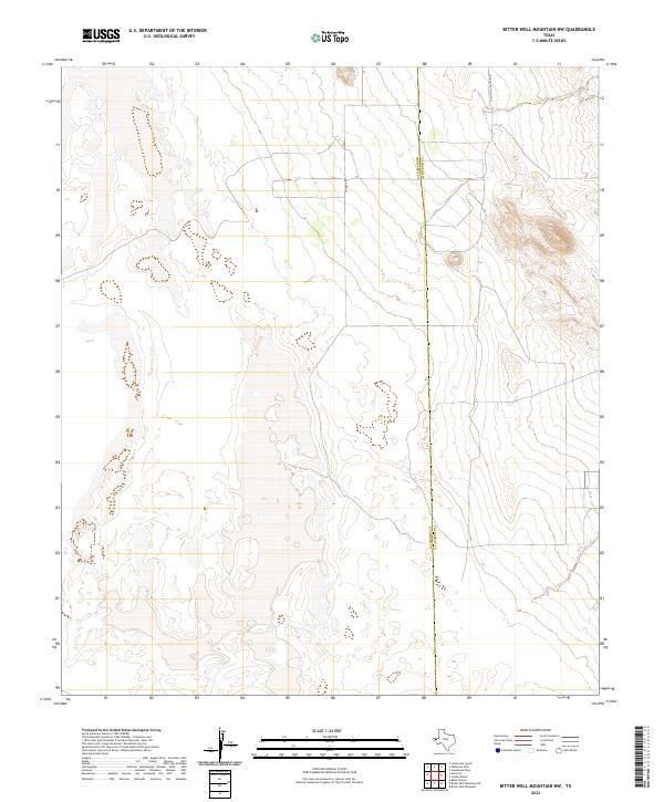
2022 Map of Bitter Well Mountain NW
USGS Topo · Published 2022About this map
The high desert terrain of West Texas defines this 2022 survey, specifically where the border of Hudspeth Co meets Culberson Co. This sparse, arid landscape is marked primarily by isolated access routes and a vast network of ephemeral water features and drainage basins. Chavez Rd cuts through the central portion of the area, providing one of the few named navigation points in an otherwise open expanse. To the north, Guadalupe School Rd provides a hint of historical local connectivity in a region dominated by salt flats and dramatic contour shifts. The survey reflects a contemporary look at this frontier environment, documenting the subtle human imprints like fence lines and unpaved roads against the permanent natural backdrop of the Trans-Pecos region.
Find a feature on this map
3 named features on this map. Tap any name to fly to it.
Don’t see what you’re looking for? This feature index may not catch every label — zoom into the map to look around manually.
Map Details
Editions of this 2022 Bitter Well Mountain NW Map
This is the sole edition of this map. No revisions or reprints were ever made.
Other maps of this area

1933 · Guadalupe Peak
USGS Topo · 1:48,000

1940 · Guadalupe Peak
USGS Topo · 1:62,500

1951 · Dell City
USGS Topo · 1:62,500

1954 · Van Horn
USGS Topo · 1:250,000

1955 · Black Mountains
USGS Topo · 1:62,500

1958 · Van Horn
USGS Topo · 1:250,000

1973 · Bitter Well Mountain NW
USGS Topo · 1:24,000

1973 · Bitter Well Mountain SW
USGS Topo · 1:24,000

1973 · Bitter Well Mountain
USGS Topo · 1:24,000
1973 · Patterson Hills
USGS Topo · 1:24,000