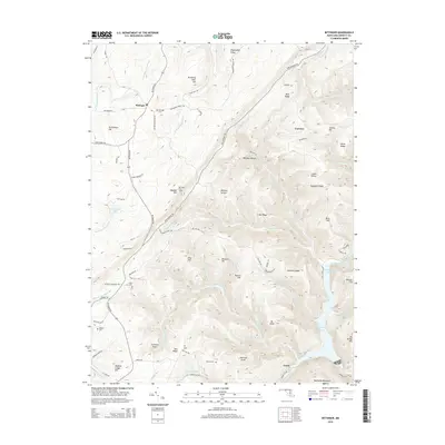
2014 Map of Bittinger
USGS Topo · Published 2014About this map
Bittinger serves as a central hub in this corner of Garrett County, situated near the headwaters of the N Br Casselman River. The landscape is defined by the high ridges of the Allegheny Mountains, including Backbone Mountain and Meadow Mtn, where the Bittinger Fire Tower overlooks the surrounding hollows. This 2014 survey documents a region defined by its narrow valleys and agricultural plateaus, with family heritage clearly marked by several rural burial grounds such as Bittinger Cem, Pritts Cem, and Murphy Cem. The southeastern portion of the map transitions into the deep waters of the Savage River Reservoir, fed by Savage River and Poplar Lick Run. The drainage patterns here are intricate, with numerous runs like Double Lick Run and Blackhawk Run carving through the terrain between prominent landmarks such as Contrary Knob and Mt Nebo.
Find a feature on this map
87 named features on this map. Tap any name to fly to it.
Don’t see what you’re looking for? This feature index may not catch every label — zoom into the map to look around manually.
Map Details
Editions of this 2014 Bittinger Map
This is the sole edition of this map. No revisions or reprints were ever made.
Other maps of this area

1895 · Piedmont
USGS Topo · 1:125,000

1899 · Grantsville
USGS Topo · 1:62,500

1899 · Oakland
USGS Topo · 1:62,500

1900 · Accident
USGS Topo · 1:62,500

1900 · Oakland
USGS Topo · 1:62,500

1904 · Grantsville
USGS Topo · 1:62,500

1919 · Elk Garden
USGS Topo · 1:48,000

1920 · Elk Garden
USGS Topo · 1:48,000

1922 · Elk Garden
USGS Topo · 1:62,500

1946 · Grantsville
USGS Topo · 1:24,000