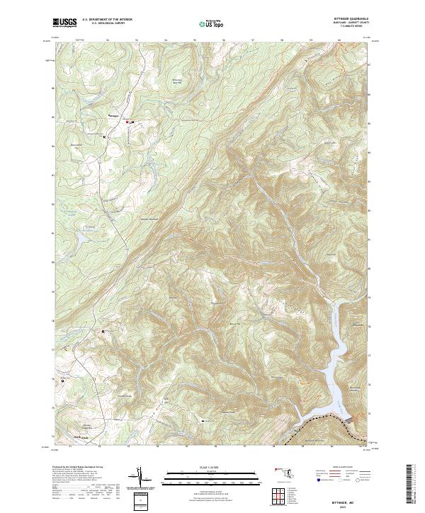
2023 Map of Bittinger
USGS Topo · Published 2023About this map
The settlement of Bittinger sits high in the Maryland mountains, where the headwaters of the North Branch Casselman River and South Branch Casselman River begin their descent. This 2023 survey illustrates a landscape defined by prominent ridgelines like Meadow Mountain and Peapatch Ridge, which separate the various drainage basins. For genealogists, the map is particularly useful for locating family burial grounds including Bittinger Mennonite Cem, Pritts Cem, and Murphy Cem, often situated near historic family homesteads along routes like Frank Brenneman Rd. The topography shifts significantly toward the southeast, where the terrain drops steeply toward the Savage River and Backbone Mountain. Small highland communities and named points like North Glade and Floyd are connected by a network of ridge-top roads, reflecting a long-standing pattern of mountain habitation and agricultural use.
Find a feature on this map
92 named features on this map. Tap any name to fly to it.
Don’t see what you’re looking for? This feature index may not catch every label — zoom into the map to look around manually.
Map Details
Editions of this 2023 Bittinger Map
This is the sole edition of this map. No revisions or reprints were ever made.
Other maps of this area

1895 · Piedmont
USGS Topo · 1:125,000

1899 · Grantsville
USGS Topo · 1:62,500

1899 · Oakland
USGS Topo · 1:62,500

1900 · Accident
USGS Topo · 1:62,500

1900 · Oakland
USGS Topo · 1:62,500

1904 · Grantsville
USGS Topo · 1:62,500

1919 · Elk Garden
USGS Topo · 1:48,000

1920 · Elk Garden
USGS Topo · 1:48,000

1922 · Elk Garden
USGS Topo · 1:62,500

1946 · Grantsville
USGS Topo · 1:24,000