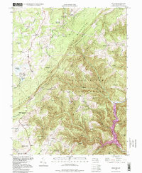
1994 Map of Bittinger
USGS Topo · Published 1999About this map
The mountain community of Bittinger serves as a focal point for this landscape in the Allegheny Mountains of Garrett County. The terrain is defined by the massive ridges of Meadow Mountain and Savage River Mountain, which channel numerous tributaries like Poplar Lick Run and Monroe Run toward the Savage River Reservoir. This 1994 data, which includes revisions from earlier 1940s topography, documents a region where state-managed lands such as Savage River State Forest and New Germany State Park intersect with private holdings. Family-named landmarks and local institutions are scattered throughout the valleys, including the Meadow Mountain Mission and several rural schools such as the Bear Hill Sch. The eastern edge is dominated by the steep descent to the Savage River Dam, illustrating the transition from high-elevation agricultural clearings to the dense, protected forests of the reservoir's watershed.
Find a feature on this map
73 named features on this map. Tap any name to fly to it.
Don’t see what you’re looking for? This feature index may not catch every label — zoom into the map to look around manually.
Map Details
Editions of this 1994 Bittinger Map
This is the sole edition of this map. No revisions or reprints were ever made.
Other maps of this area

1895 · Piedmont
USGS Topo · 1:125,000

1899 · Grantsville
USGS Topo · 1:62,500

1899 · Oakland
USGS Topo · 1:62,500

1900 · Accident
USGS Topo · 1:62,500

1900 · Oakland
USGS Topo · 1:62,500

1904 · Grantsville
USGS Topo · 1:62,500

1919 · Elk Garden
USGS Topo · 1:48,000

1920 · Elk Garden
USGS Topo · 1:48,000

1922 · Elk Garden
USGS Topo · 1:62,500

1946 · Grantsville
USGS Topo · 1:24,000