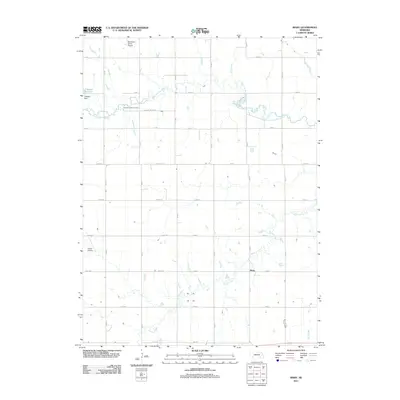
2011 Map of Bixby
USGS Topo · Published 2011About this map
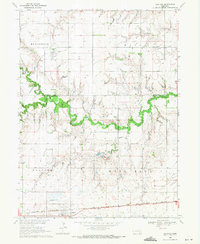
The West Fork Big Blue River meanders across this rural section of Fillmore County, defining a landscape of agricultural utility and quiet settlements. In the early 21st century, the area around Bixby is characterized by a precise grid of rural routes such as Road 322 and Road B, which connect isolated farmsteads and specialized local infrastructure. Water management is central to the terrain, evidenced by the Thieszen Reservoir and Thieszen Dam in the northwest. For those researching local heritage, the Farmers Valley Cemetery stands as a permanent fixture on Farmers Valley Rd. The map also highlights the importance of local aviation in this open country, noting the Boardman Aerial Airport and Traudt Airport, while smaller drainages like School Creek and Elk Run provide the natural hydrology that supports the surrounding farmland.
Find a feature on this map
34 named features on this map. Tap any name to fly to it.
Don’t see what you’re looking for? This feature index may not catch every label — zoom into the map to look around manually.
Map Details
Editions of this 2011 Bixby Map
This is the sole edition of this map. No revisions or reprints were ever made.
Other maps of this area

1898 · York
USGS Topo · 1:125,000

1899 · York
USGS Topo · 1:125,000

1955 · Lincoln
USGS Topo · 1:250,000

1957 · Lincoln
USGS Topo · 1:250,000

1958 · Lincoln
USGS Topo · 1:250,000
1968 · Aurora East
USGS Topo · 1:24,000
1968 · Henderson
USGS Topo · 1:24,000

1969 · Bixby
USGS Topo · 1:24,000
1969 · Saronville
USGS Topo · 1:24,000
1969 · Grafton
USGS Topo · 1:24,000