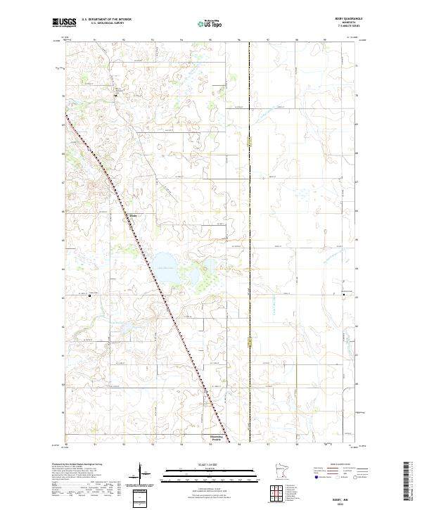
2022 Map of Bixby
USGS Topo · Published 2022About this map
Bixby sits at a crossroads in the southern Minnesota farmland, where the straight lines of the county road system meet the winding course of Turtle Cr. This landscape is defined by its drainage and water management, featuring a network of engineered waterways like Ebeling Ditch and Green Valley Ditch that support the surrounding agricultural economy. The area is dotted with natural bodies of water including Oak Glen Lake and Rickert Lake, which break up the geometric township and range sections. The county line between Steele and Dodge Counties runs vertically through the center of the survey, separating different jurisdictional grids. For those researching local heritage, the map identifies three significant burial sites: Aurora Township Cem to the north, Union Cem near the center, and Westfield Cem on the eastern edge. To the south, the map reaches the northern outskirts of Blooming Prairie.
Find a feature on this map
52 named features on this map. Tap any name to fly to it.
Don’t see what you’re looking for? This feature index may not catch every label — zoom into the map to look around manually.
Map Details
Editions of this 2022 Bixby Map
This is the sole edition of this map. No revisions or reprints were ever made.
Other maps of this area

1953 · Saint Paul
USGS Topo · 1:250,000

1954 · Mason City
USGS Topo · 1:250,000

1957 · Mason City
USGS Topo · 1:250,000

1958 · Mason City
USGS Topo · 1:250,000

1959 · Saint Paul
USGS Topo · 1:250,000

1962 · Owatonna
USGS Topo · 1:24,000

1962 · Owatonna SE
USGS Topo · 1:24,000

1965 · Claremont
USGS Topo · 1:24,000

1966 · Waltham
USGS Topo · 1:24,000

1966 · Hayfield NW
USGS Topo · 1:24,000