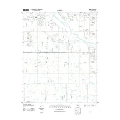
2012 Map of Bixby
USGS Topo · Published 2012About this map
The Arkansas River winds through the northern portion of this 2012 survey, defining the landscape between the growing communities of Jenks and Bixby. This suburban corridor south of Tulsa shows a transition from structured street grids to the open, creek-fed terrain near Applegate Hill. Local history and genealogy are anchored by established sites like Bixby Cem and Duck Creek Cem, which sit amidst a network of expanding residential roads and historical watercourses including Posey Cr and Duck Creek. The mapping reveals how modern development has integrated with the natural drainage patterns of the river valley, maintaining distinct settlement clusters while infilling the spaces between them with named avenues and streets. This record is particularly valuable for tracing the transformation of the Oklahoma landscape as it evolved from rural farmland into a connected metropolitan extension.
Find a feature on this map
151 named features on this map. Tap any name to fly to it.
Don’t see what you’re looking for? This feature index may not catch every label — zoom into the map to look around manually.
Map Details
Editions of this 2012 Bixby Map
This is the sole edition of this map. No revisions or reprints were ever made.
Other maps of this area

1896 · Okmulgee
USGS Topo · 1:125,000

1900 · Okmulgee
USGS Topo · 1:125,000

1901 · Claremore
USGS Topo · 1:125,000

1901 · Nuyaka
USGS Topo · 1:125,000

1912 · Hominy
USGS Topo · 1:125,000

1914 · Kiefer
USGS Topo · 1:62,500

1914 · Claremore
USGS Topo · 1:125,000

1915 · Hominy
USGS Topo · 1:125,000

1916 · Kiefer
USGS Topo · 1:62,500

1916 · Claremore
USGS Topo · 1:125,000