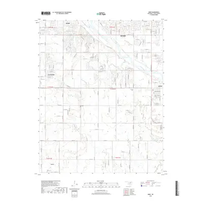
2018 Map of Bixby
USGS Topo · Published 2018About this map
The Arkansas River winds through the northern half of this landscape, separating the residential expansions of Tulsa and Jenks from the southern plains. This area captures a modern view of the suburban and rural interface south of the city, where the established grid of Glenpool and the town of Bixby anchor the local geography. Significant for genealogists and local historians, the map documents the Bixby Cem and the Duck Creek Cem near the southern settlement of Liberty. The terrain is characterized by gentle shifts in elevation, most notably at Applegate Hill, and the drainage patterns of Posey Cr and Duck Cr. This 2018 survey provides an exact record of the road network, including the heavily developed corridors of S Memorial Dr and S Peoria Ave as they connect these growing Oklahoma communities.
Find a feature on this map
132 named features on this map. Tap any name to fly to it.
Don’t see what you’re looking for? This feature index may not catch every label — zoom into the map to look around manually.
Map Details
Editions of this 2018 Bixby Map
This is the sole edition of this map. No revisions or reprints were ever made.
Other maps of this area

1896 · Okmulgee
USGS Topo · 1:125,000

1900 · Okmulgee
USGS Topo · 1:125,000

1901 · Claremore
USGS Topo · 1:125,000

1901 · Nuyaka
USGS Topo · 1:125,000

1912 · Hominy
USGS Topo · 1:125,000

1914 · Kiefer
USGS Topo · 1:62,500

1914 · Claremore
USGS Topo · 1:125,000

1915 · Hominy
USGS Topo · 1:125,000

1916 · Kiefer
USGS Topo · 1:62,500

1916 · Claremore
USGS Topo · 1:125,000