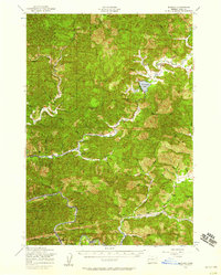
1956 Map of Blachly
USGS Topo · Published 1958About this map
The Siuslaw National Forest dominates this mid-century portrait of the Oregon Coast Range, where the drainage of Lake Creek creates a unique natural focal point at Triangle Lake. Near the lake, a local Log Pond and the Triangle Lake Sch suggest a landscape defined by the timber industry and small, self-contained communities. Small settlements like Blachly, Greenleaf, and Alpha are linked by winding mountain roads, while the southern portion of the map shows the corridor of the Southern Pacific railroad following the path of Wildcat Creek toward Walton. This 1950s survey documents a network of rural education and forestry management, including the Nelson Guard Station and several neighborhood schools such as Deadwood Sch and Siuslaw Sch. Local genealogy is anchored by the Lyons Cem and the Lyons Sch in the southeast, marking the persistence of family-named landmarks in the rugged terrain between Windy Peak and Badger Mtn.
Find a feature on this map
67 named features on this map. Tap any name to fly to it.
Don’t see what you’re looking for? This feature index may not catch every label — zoom into the map to look around manually.
Map Details
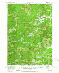
Editions of this 1956 Blachly Map
2 editions found
Other maps of this area

1909 · Elmira
USGS Topo · 1:62,500

1918 · Mapleton
USGS Topo · 1:48,000

1919 · Earl
USGS Topo · 1:48,000

1922 · Monroe
USGS Topo · 1:62,500

1922 · Elmira
USGS Topo · 1:62,500

1939 · Monroe
USGS Topo · 1:62,500

1940 · Mapleton
USGS Topo · 1:62,500

1941 · Blachly
USGS Topo · 1:62,500

1942 · Alsea
USGS Topo · 1:62,500

1942 · Elmira
USGS Topo · 1:62,500