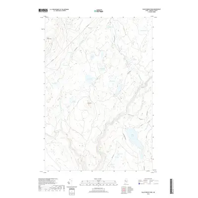
2018 Map of Black Brook Pond
USGS Topo · Published 2018About this map
The Kennebec River carves a deep valley through this Somerset County landscape, serving as a primary corridor for seasonal access and recreation. The terrain is defined by a dense network of remote water bodies, including the centrally located Ellis Pond and the Squirtgun Flowage to the north. Elevated landmarks such as Wilson Hill and Cold Stream Mtn overlook a complex hydrology of drainages like Tomhegan Stream and Chase Stream. A system of timber and access roads, including Capital Rd and Dead Stream Rd, weave between these ponds, reflecting the area's history as working forest land. The distribution of smaller bodies like Horseshoe Pond and Flatiron Pond suggests a glacially influenced topography where water collection in basins is the dominant geographic feature.
Find a feature on this map
38 named features on this map. Tap any name to fly to it.
Don’t see what you’re looking for? This feature index may not catch every label — zoom into the map to look around manually.
Map Details
Editions of this 2018 Black Brook Pond Map
This is the sole edition of this map. No revisions or reprints were ever made.
Other maps of this area

1905 · The Forks
USGS Topo · 1:62,500

1907 · The Forks
USGS Topo · 1:62,500

1921 · Brassua Lake
USGS Topo · 1:62,500

1922 · Long Pond
USGS Topo · 1:62,500

1923 · Brassua Lake
USGS Topo · 1:62,500

1924 · Long Pond
USGS Topo · 1:62,500

1925 · Pierce Pond
USGS Topo · 1:48,000

1927 · Pierce Pond
USGS Topo · 1:62,500

1944 · Brassua Lake
USGS Topo · 1:62,500

1944 · Long Pond
USGS Topo · 1:62,500
Featured Places
- West Forks, ME
- Johnson Mountain Township, ME
- Chase Stream Township, ME
- Moxie Gore, ME
- Indian Stream Township, ME