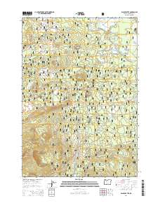
2014 Map of Black Crater
USGS Topo · Published 2014About this map
The Cascade Range defines the topography of this portion of the Deschutes National Forest, where volcanic landmarks dominate the horizon. Elevated peaks such as Black Crater and Latta Crater overlook a complex network of forest development roads, providing a detailed look at the access points used for timber management and fire suppression in the early 21st century. The drainage patterns of the area are marked by several ephemeral and perennial sources, including Cache Cr and Trout Cr, which flow through the high-elevation terrain toward the lower meadows.
Find a feature on this map
42 named features on this map. Tap any name to fly to it.
Don’t see what you’re looking for? This feature index may not catch every label — zoom into the map to look around manually.
Map Details
Editions of this 2014 Black Crater Map
This is the sole edition of this map. No revisions or reprints were ever made.
Other maps of this area

1929 · Three Sisters
USGS Topo · 1:125,000

1932 · Three Sisters
USGS Topo · 1:125,000

1955 · Bend
USGS Topo · 1:250,000

1957 · Bend
USGS Topo · 1:250,000

1958 · Bend
USGS Topo · 1:250,000

1959 · Broken Top
USGS Topo · 1:62,500
1959 · Three Sisters
USGS Topo · 1:62,500

1959 · Three Fingered Jack
USGS Topo · 1:62,500

1959 · Sisters
USGS Topo · 1:62,500
1980 · Bend
USGS Topo · 1:100,000