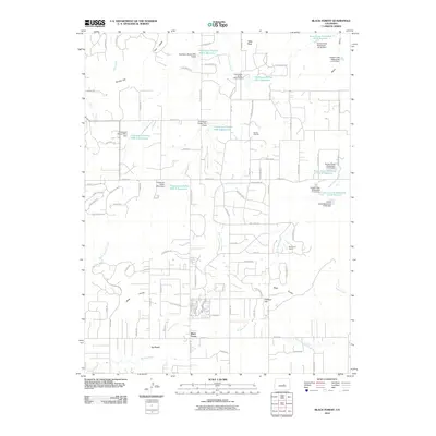
2010 Map of Black Forest
USGS Topo · Published 2010About this map
Black Forest and the neighboring community of La Foret anchor this section of the Palmer Divide, where the ponderosa pine canopy meets the rolling terrain of the Colorado Piedmont. The landscape is defined by a dense network of residential development, with newer streets like Mountain Dance Dr and Hidden Rock Rd expanding into the timbered hills. This modern growth is built over an older ranching foundation, evidenced by the Old Bar X Ranch and Pine Cone Ranch.
Find a feature on this map
96 named features on this map. Tap any name to fly to it.
Don’t see what you’re looking for? This feature index may not catch every label — zoom into the map to look around manually.
Map Details
Editions of this 2010 Black Forest Map
This is the sole edition of this map. No revisions or reprints were ever made.
Other maps of this area

1893 · Colorado Springs
USGS Topo · 1:125,000

1894 · Castle Rock
USGS Topo · 1:125,000

1909 · Colorado Springs
USGS Topo · 1:125,000

1913 · Castle Rock
USGS Topo · 1:125,000

1940 · Elbert
USGS Topo · 1:62,500

1942 · Colorado Springs
USGS Topo · 1:125,000

1944 · Elbert
USGS Topo · 1:62,500

1948 · Falcon
USGS Topo · 1:24,000

1948 · Colorado Springs
USGS Topo · 1:62,500

1948 · Pikeview
USGS Topo · 1:24,000