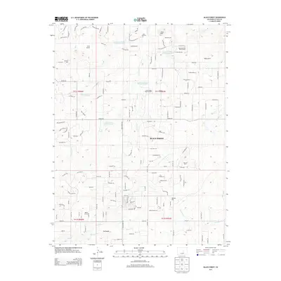
2013 Map of Black Forest
USGS Topo · Published 2013About this map
Black Forest occupies the center of this high-altitude landscape, where residential development in the early 21st century follows a dense grid of local roads and drives. The area is defined by its numerous small-scale water management features, including several Franktown Parker FPE-2 through FPE-6 Reservoirs. Toward the south, the settlement of La Foret lies near the Burgess River, while private ranching and aviation interests are scattered throughout, represented by the Old Bar X Ranch and Mountain View Ranch Airport. Local genealogy and land use can be traced through sites like Table Rock Cem and the surrounding terrain of Table Rock and Spruce Hill. The drainage patterns of Elk Cr, E Cherry Cr, and Black Squirrel Cr illustrate the watershed's significance to this community on the edge of the plains.
Find a feature on this map
141 named features on this map. Tap any name to fly to it.
Don’t see what you’re looking for? This feature index may not catch every label — zoom into the map to look around manually.
Map Details
Editions of this 2013 Black Forest Map
This is the sole edition of this map. No revisions or reprints were ever made.
Other maps of this area

1893 · Colorado Springs
USGS Topo · 1:125,000

1894 · Castle Rock
USGS Topo · 1:125,000

1909 · Colorado Springs
USGS Topo · 1:125,000

1913 · Castle Rock
USGS Topo · 1:125,000

1940 · Elbert
USGS Topo · 1:62,500

1942 · Colorado Springs
USGS Topo · 1:125,000

1944 · Elbert
USGS Topo · 1:62,500

1948 · Falcon
USGS Topo · 1:24,000

1948 · Colorado Springs
USGS Topo · 1:62,500

1948 · Pikeview
USGS Topo · 1:24,000