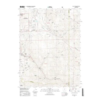
2016 Map of Black Hawk
USGS Topo · Published 2016About this map
Black Hawk and Central City anchor this 2016 survey of the high-elevation terrain where Gilpin, Clear Creek, and Jefferson counties meet. The map traces the dense network of drainage and terrain features that defined the early mining era, from Gregory Gulch to Russell Gulch, highlighting how the modern footprint of these towns remains tied to the steep slopes of Gregory Hill and Signal Hill. This area is a patchwork of public and private lands, with significant portions managed as part of the Roosevelt National Forest and Arapaho National Forest.
Find a feature on this map
128 named features on this map. Tap any name to fly to it.
Don’t see what you’re looking for? This feature index may not catch every label — zoom into the map to look around manually.
Map Details
Editions of this 2016 Black Hawk Map
This is the sole edition of this map. No revisions or reprints were ever made.
Other maps of this area

1899 · West Denver
USGS Topo · 1:125,000

1903 · Georgetown
USGS Topo · 1:62,500

1905 · Central City
USGS Topo · 1:62,500

1905 · Georgetown
USGS Topo · 1:62,500

1906 · Blackhawk
USGS Topo · 1:62,500

1910 · Central City
USGS Topo · 1:62,500

1912 · Central City
USGS Topo · 1:62,500

1942 · Eldorado Springs
USGS Topo · 1:24,000

1942 · Nederland
USGS Topo · 1:24,000

1942 · Central City
USGS Topo · 1:24,000