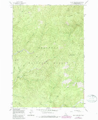
1966 Map of Black Hawk Mtn
USGS Topo · Published 1987About this map
Blue Ribbon Mine and the Red Horse Dredge highlight a landscape of intensive mineral extraction within the Nez Perce National Forest. This mountainous Idaho terrain is defined by its deep drainages and legacy of lode and placer mining, with several named operations scattered across the slopes of Blue Ribbon Mtn and Black Hawk Mtn. Evidence of historic activity is present in the form of the American Eagle Mine and Altermont Mine, which are connected by a network of steep pack trails and jeep roads. The drainage system, including Red Horse Creek and Siegel Creek, provided the necessary water for these operations. In the southern portion of the map, the Red River flows toward the Red River Campground, serving as a primary corridor through the wilderness. These details offer a specialized look at the mid-20th-century footprint of Idaho's mining history.
Find a feature on this map
28 named features on this map. Tap any name to fly to it.
Don’t see what you’re looking for? This feature index may not catch every label — zoom into the map to look around manually.
Map Details
Editions of this 1966 Black Hawk Mtn Map
3 editions found
Other maps of this area

1956 · Elk City
USGS Topo · 1:250,000

1960 · Elk City
USGS Topo · 1:250,000

1966 · Elk City
USGS Topo · 1:24,000

1966 · Black Hawk Mtn
USGS Topo · 1:24,000

1966 · Lick Point
USGS Topo · 1:24,000

1966 · Sable Hill
USGS Topo · 1:24,000

1966 · Anderson Butte
USGS Topo · 1:24,000
1966 · Vermilion Peak
USGS Topo · 1:24,000

1977 · Boston Mtn
USGS Topo · 1:24,000

1978 · Moose Butte
USGS Topo · 1:24,000