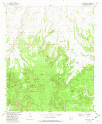
1981 Map of Black Hill
USGS Topo · Published 1981About this map
Black Peak stands as the central topographic focal point within the Apache National Forest, overlooking a landscape defined by seasonal water sources and rugged canyons. The area's reliance on intermittent water is evident in the density of named catchments and tanks, such as Buck Tank, No Agua Tank, and Trap Tank, which supported livestock and wildlife in this high-altitude terrain. Early ranching and range management footprints are visible through features like the Johnson Basin Windmill and the network of jeep trails that navigate the complex topography.
Find a feature on this map
29 named features on this map. Tap any name to fly to it.
Don’t see what you’re looking for? This feature index may not catch every label — zoom into the map to look around manually.
Map Details
Editions of this 1981 Black Hill Map
This is the sole edition of this map. No revisions or reprints were ever made.
Other maps of this area

1954 · Tularosa
USGS Topo · 1:250,000

1958 · Tularosa
USGS Topo · 1:250,000

1961 · Sierra Fijardo
USGS Topo · 1:24,000

1961 · Hickman Ranch
USGS Topo · 1:24,000

1961 · Paraje Well
USGS Topo · 1:24,000

1961 · Black Hill
USGS Topo · 1:24,000

1961 · Fort Craig
USGS Topo · 1:24,000

1961 · Lava
USGS Topo · 1:24,000

1961 · Romero Canyon
USGS Topo · 1:24,000

1964 · San Juan Peak
USGS Topo · 1:24,000