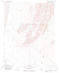
1973 Map of Black Hills SW
USGS Topo · Published 1977About this map
The Desert Range dominates this corner of Nevada, where the high ridges of the Black Hills meet the low-lying Three Lakes Depression. This landscape is defined by its role as a restricted military and conservation area, containing significant portions of the Nellis Air Force Range and the National Wildlife Range. The presence of a Protective Dome and a designated Target Area suggests the specialized use of the terrain for defense testing and observation during the mid-1970s. Industrial and transit history is visible in the lower sections of the map, specifically through the Old Railroad Grade and the Borrow Pit. Water remains the primary constraint in this arid environment, marked by an isolated Dry Well and a Guzzler, while unpaved routes like Alamo Road and Cow Camp Road provide the only access through the rugged foothills.
Find a feature on this map
16 named features on this map. Tap any name to fly to it.
Don’t see what you’re looking for? This feature index may not catch every label — zoom into the map to look around manually.
Map Details
Editions of this 1973 Black Hills SW Map
2 editions found
Other maps of this area

1907 · Las Vegas
USGS Topo · 1:250,000

1908 · Las Vegas
USGS Topo · 1:250,000

1942 · Indian Spring
USGS Topo · 1:125,000

1945 · Sheep Range
USGS Topo · 1:125,000

1952 · Corn Creek Springs
USGS Topo · 1:62,500

1954 · Las Vegas
USGS Topo · 1:250,000

1957 · Las Vegas
USGS Topo · 1:250,000

1957 · Charleston Peak
USGS Topo · 1:62,500

1959 · Las Vegas
USGS Topo · 1:250,000

1962 · Las Vegas
USGS Topo · 1:250,000