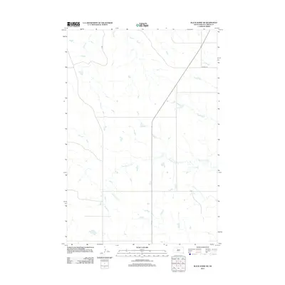
2012 Map of Black Horse SW
USGS Topo · Published 2012About this map
Standing Cloud Creek meanders through this section of the Corson County landscape, defining the local drainage patterns across the prairie. The terrain in this part of South Dakota is characterized by its wide, open spaces and the subtle incisions made by watercourses like Louse Creek, which cuts through the northwestern portion of the map. Human development is marked primarily by a sparse grid of rural thoroughfares, most notably the intersection of Firesteel Road and North Dakota Highway 65. These transportation routes, along with local paths like 129 Street, provide the essential framework for ranching and transit in this expansive region of the Rock Creek District.
Find a feature on this map
4 named features on this map. Tap any name to fly to it.
Don’t see what you’re looking for? This feature index may not catch every label — zoom into the map to look around manually.
Map Details
Editions of this 2012 Black Horse SW Map
This is the sole edition of this map. No revisions or reprints were ever made.
Other maps of this area

1953 · McIntosh
USGS Topo · 1:250,000

1956 · Black Horse NE
USGS Topo · 1:24,000

1956 · Black Horse SW
USGS Topo · 1:24,000

1956 · Cottonwood Creek NE
USGS Topo · 1:24,000

1956 · Black Horse SE
USGS Topo · 1:24,000

1956 · Black Horse
USGS Topo · 1:24,000

1956 · Cottonwood Creek SE
USGS Topo · 1:24,000

1958 · McIntosh
USGS Topo · 1:250,000

1978 · Isabel
USGS Topo · 1:24,000
1978 · Firesteel
USGS Topo · 1:24,000