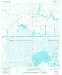
1955 Map of Black Lake
USGS Topo · Published 1986About this map
The Bayou Chourique Oil and Gas Field and the West Hackberry Oil Field dominate this coastal landscape, illustrating the mid-century industrial footprint on the Louisiana marshlands. This 1955 survey reveals a complex network of resource extraction and transit infrastructure, including an extensive system of pipelines and the vital Intracoastal Waterway. This shipping artery is further detailed by the Gardiner Slip and numerous depth markers.
Find a feature on this map
19 named features on this map. Tap any name to fly to it.
Don’t see what you’re looking for? This feature index may not catch every label — zoom into the map to look around manually.
Map Details
Editions of this 1955 Black Lake Map
4 editions found
Other maps of this area

1932 · Moss Lake
USGS Topo · 1:31,680

1932 · Orange
USGS Topo · 1:62,500

1934 · Browns Lake
USGS Topo · 1:24,000

1934 · Five Lakes
USGS Topo · 1:24,000

1935 · Five Lakes
USGS Topo · 1:31,680

1935 · Hackberry
USGS Topo · 1:31,680

1935 · Browns Lake
USGS Topo · 1:31,680

1946 · Moss Lake
USGS Topo · 1:31,680

1947 · Sulphur
USGS Topo · 1:31,680

1947 · Vinton
USGS Topo · 1:31,680