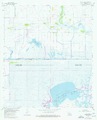
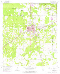
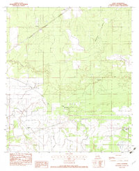
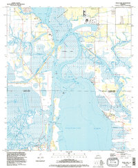
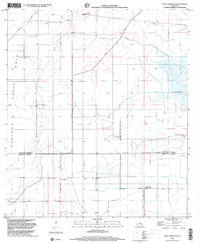
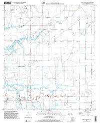
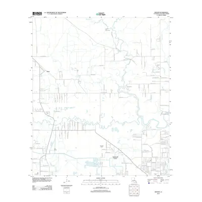
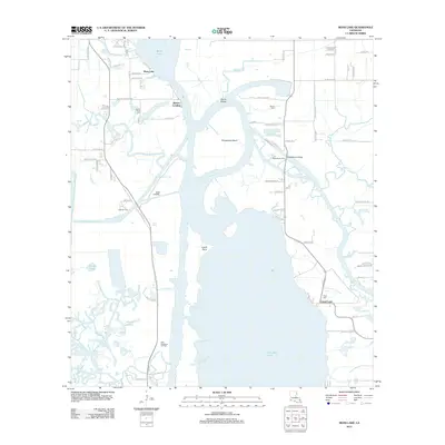
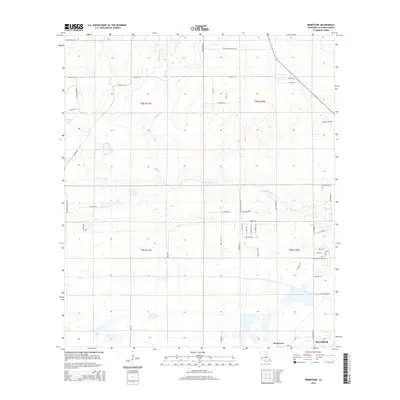
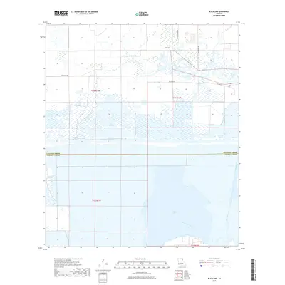
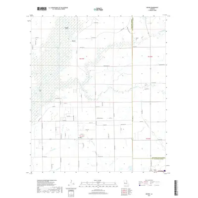
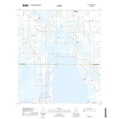
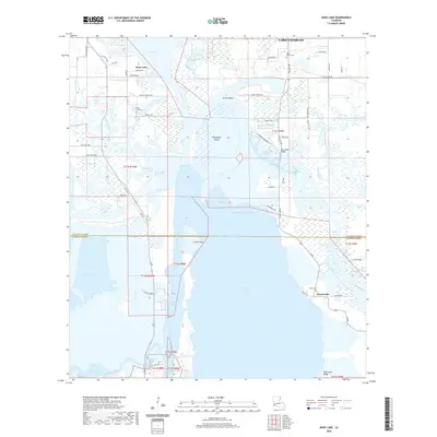
1955 Map of Black Lake
USGS Topo · Published 1955About this map
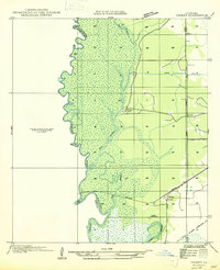
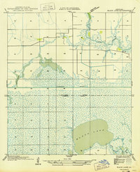
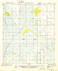
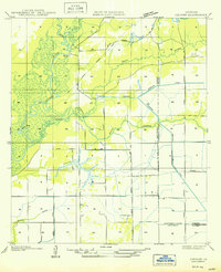
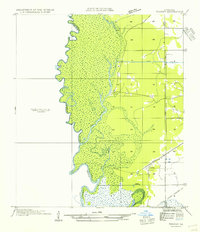
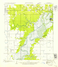
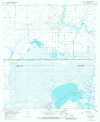
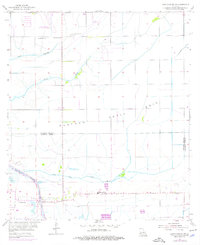
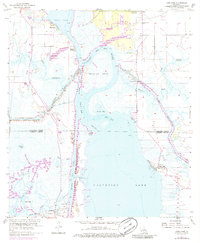
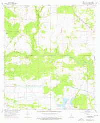
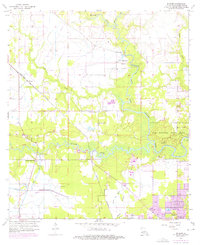
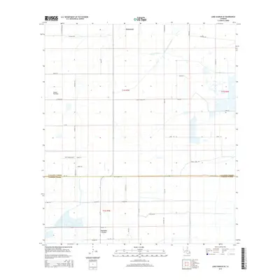
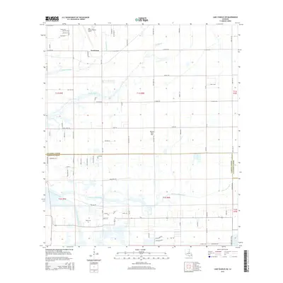
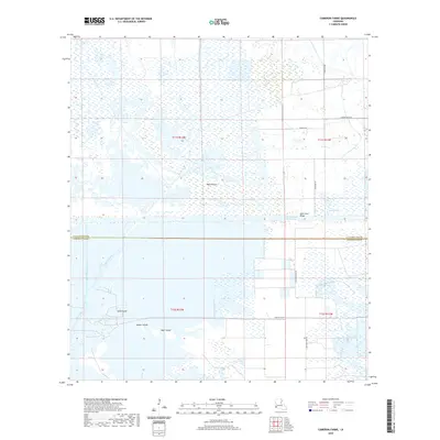
West Hackberry Oil and Gas Field anchors the southern landscape of this coastal survey, where the industrial extraction of Louisiana's natural resources meets a complex network of marshlands and waterways. The map illustrates the boundary between Calcasieu Parish and Cameron Parish, dominated by the wide expanse of Black Lake and the Intracoastal Waterway. This era of development is marked by extensive energy infrastructure, including numerous pipelines and oil wells that crisscross the low-lying terrain near Clear Marais and Bayou Chouprique. Local family history is preserved at the Moss Cem and Landry Cem, providing vital points of reference for genealogists. The water-dependent economy is further evidenced by features like the Gardiner Slip, Sabine Canal, and Alkali Ditch, which define the drainage and transport patterns of the mid-20th-century Gulf Coast.
Find a feature on this map
18 named features on this map. Tap any name to fly to it.
Don’t see what you’re looking for? This feature index may not catch every label — zoom into the map to look around manually.
Map Details
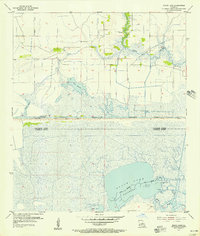
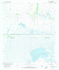
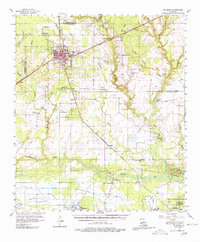
Editions of this 1955 Black Lake Map
4 editions found
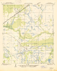
Historical Maps of Hackberry Through Time
82 maps found

1932 Lake Charles NE
Calcasieu Parish, LA

1932 Lake Charles NW
Calcasieu Parish, LA

1932 Lake Charles SE
Calcasieu Parish, LA

1932 Lake Charles SW
Calcasieu Parish, LA

1932 Moss Lake
Calcasieu Parish, LA

1935 Buhler
Calcasieu Parish, LA

1946 Moss Lake
Calcasieu Parish, LA

1947 Hecker
Calcasieu Parish, LA
1947 Lunita
Calcasieu Parish, LA

1947 Sulphur Mines
Calcasieu Parish, LA
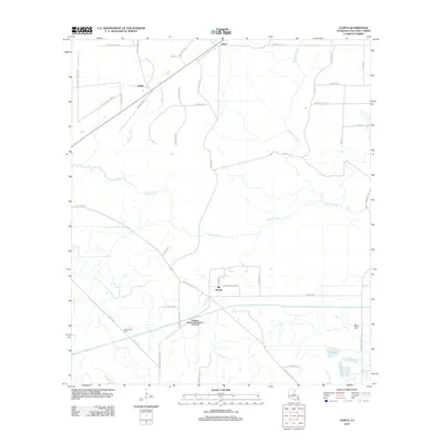
1947 Toomey
Calcasieu Parish, LA

1947 West Lake
Calcasieu Parish, LA
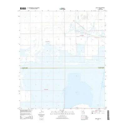
1949 Black Lake
Calcasieu Parish, LA
1949 Cameron Farms
Calcasieu Parish, LA
1950 Hecker
Calcasieu Parish, LA
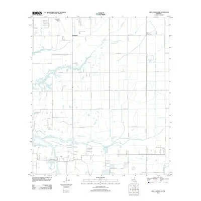
1954 Toomey
Calcasieu Parish, LA
1954 West Lake
Calcasieu Parish, LA
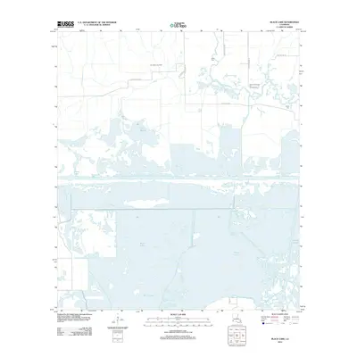
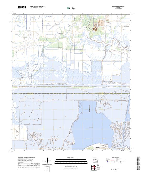
1955 Black Lake
Calcasieu Parish, LA
1955 Lake Charles SE
Calcasieu Parish, LA
1955 Lake Charles SW
Calcasieu Parish, LA
1955 Moss Lake
Calcasieu Parish, LA
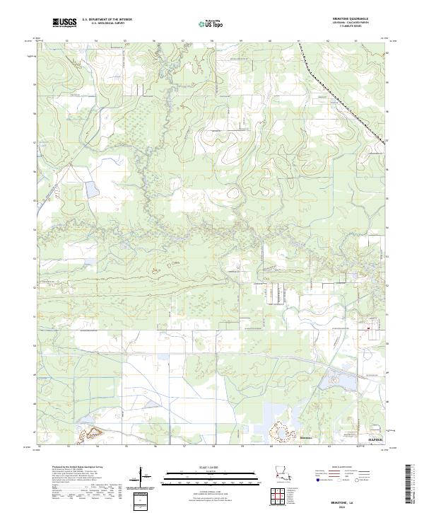
1956 Brimstone
Calcasieu Parish, LA
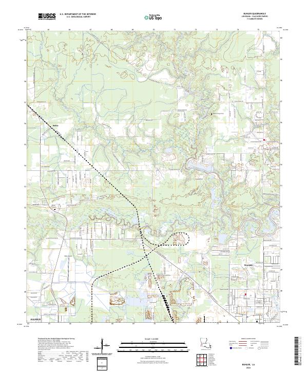
1956 Buhler
Calcasieu Parish, LA
1956 De Quincy
Calcasieu Parish, LA
1956 De Quincy
Calcasieu Parish, LA
1956 Hecker
Calcasieu Parish, LA
1960 Cameron Farms
Calcasieu Parish, LA
1982 Lunita
Calcasieu Parish, LA
1994 De Quincy
Calcasieu Parish, LA
1994 Hecker
Calcasieu Parish, LA
1994 Lunita
Calcasieu Parish, LA
1994 Moss Lake
Calcasieu Parish, LA
1998 Black Lake
Calcasieu Parish, LA
1998 Brimstone
Calcasieu Parish, LA
1998 Buhler
Calcasieu Parish, LA
1998 Lake Charles SE
Calcasieu Parish, LA
1998 Lake Charles SW
Calcasieu Parish, LA
2012 Black Lake
Calcasieu Parish, LA
2012 Brimstone
Calcasieu Parish, LA
2012 Buhler
Calcasieu Parish, LA
2012 Cameron Farms
Calcasieu Parish, LA
2012 Hecker
Calcasieu Parish, LA
2012 Lake Charles SE
Calcasieu Parish, LA
2012 Lake Charles SW
Calcasieu Parish, LA
2012 Lunita
Calcasieu Parish, LA
2012 Moss Lake
Calcasieu Parish, LA
2015 Black Lake
Calcasieu Parish, LA
2015 Brimstone
Calcasieu Parish, LA
2015 Buhler
Calcasieu Parish, LA
2015 Cameron Farms
Calcasieu Parish, LA
2015 Hecker
Calcasieu Parish, LA
2015 Lake Charles SE
Calcasieu Parish, LA
2015 Lake Charles SW
Calcasieu Parish, LA
2015 Lunita
Calcasieu Parish, LA
2015 Moss Lake
Calcasieu Parish, LA
2018 Black Lake
Calcasieu Parish, LA
2018 Brimstone
Calcasieu Parish, LA
2018 Buhler
Calcasieu Parish, LA
2018 Cameron Farms
Calcasieu Parish, LA
2018 Hecker
Calcasieu Parish, LA
2018 Lake Charles SE
Calcasieu Parish, LA
2018 Lake Charles SW
Calcasieu Parish, LA
2018 Lunita
Calcasieu Parish, LA
2018 Moss Lake
Calcasieu Parish, LA
2020 Black Lake
Calcasieu Parish, LA
2020 Brimstone
Calcasieu Parish, LA
2020 Buhler
Calcasieu Parish, LA
2020 Cameron Farms
Calcasieu Parish, LA

2020 Hecker
Calcasieu Parish, LA
2020 Lake Charles SE
Calcasieu Parish, LA
2020 Lake Charles SW
Calcasieu Parish, LA
2020 Lunita
Calcasieu Parish, LA
2020 Moss Lake
Calcasieu Parish, LA
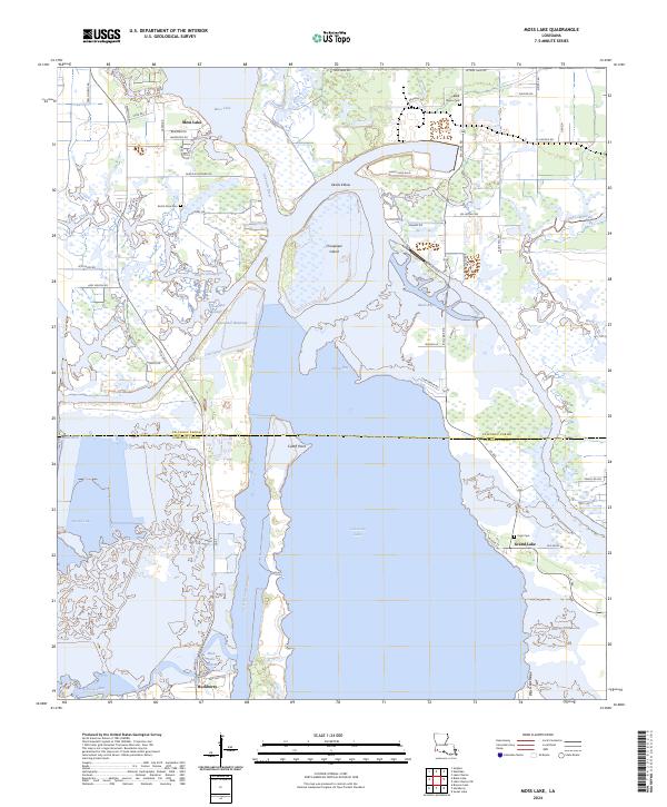
2024 Black Lake
Calcasieu Parish, LA
2024 Brimstone
Calcasieu Parish, LA
2024 Buhler
Calcasieu Parish, LA
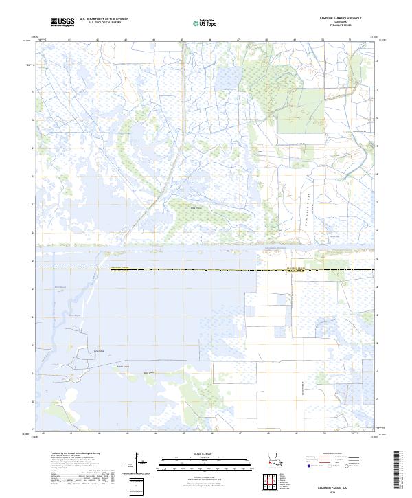
2024 Cameron Farms
Calcasieu Parish, LA
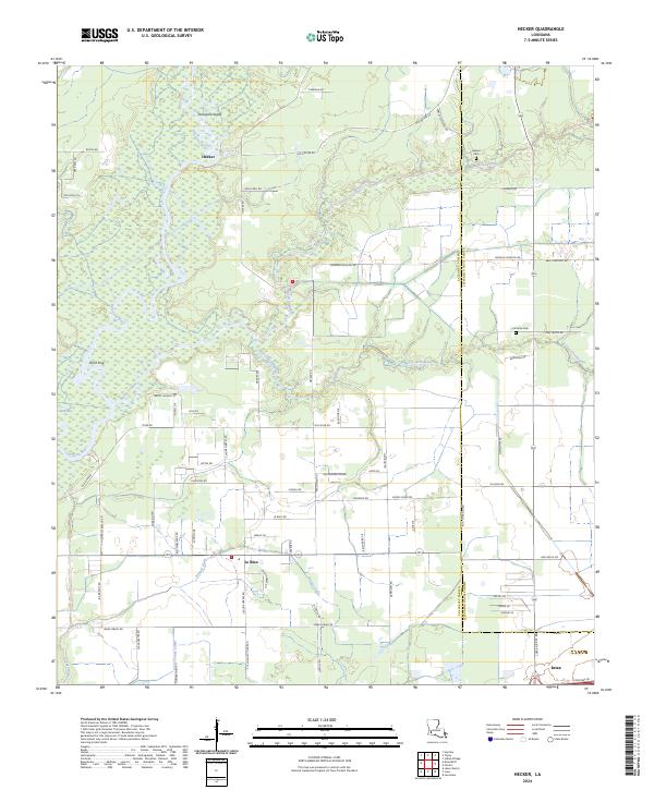
2024 Hecker
Calcasieu Parish, LA
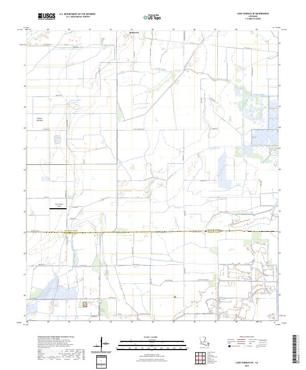
2024 Lake Charles SE
Calcasieu Parish, LA
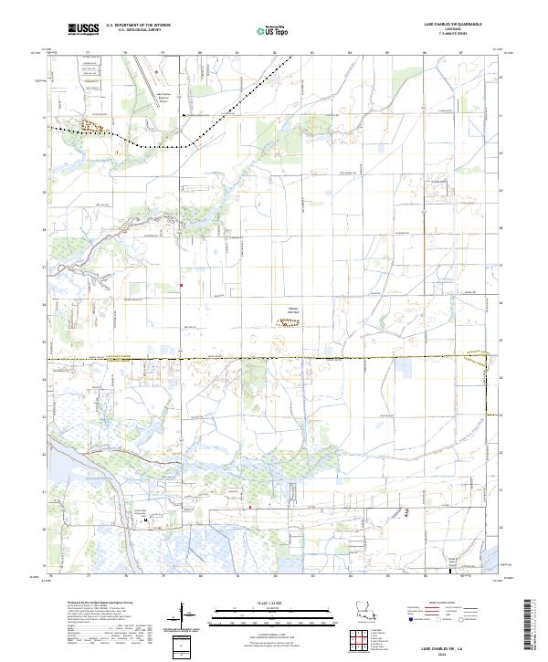
2024 Lake Charles SW
Calcasieu Parish, LA
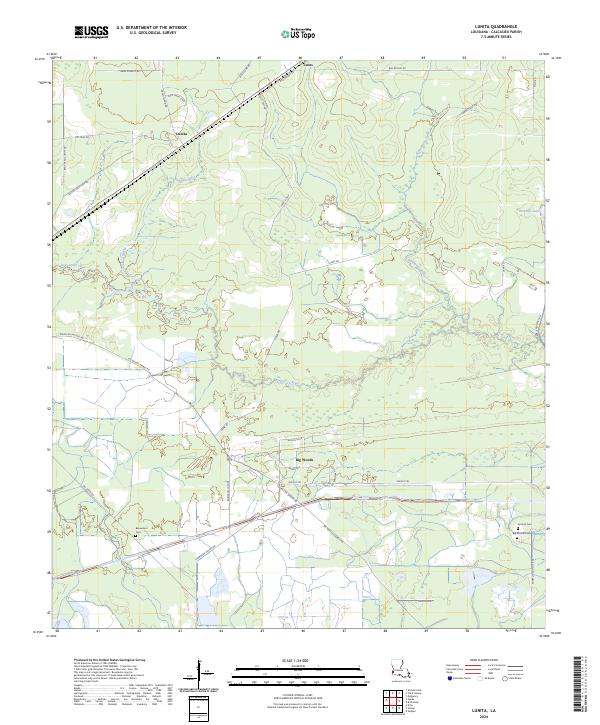
2024 Lunita
Calcasieu Parish, LA
2024 Moss Lake
Calcasieu Parish, LA