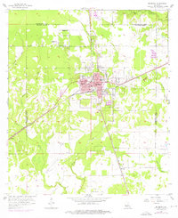
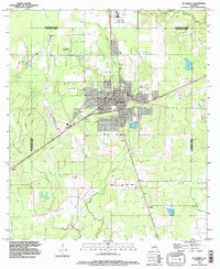
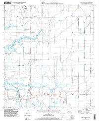
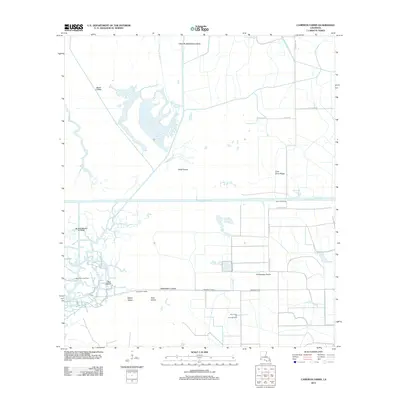
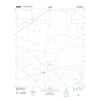
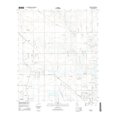
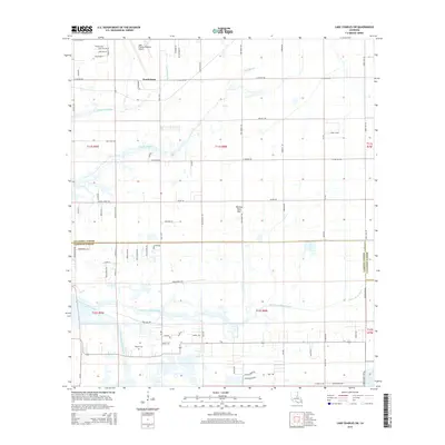
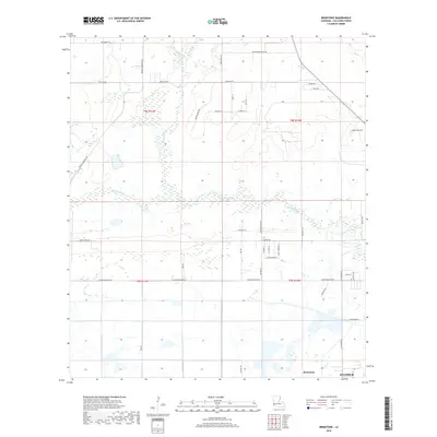
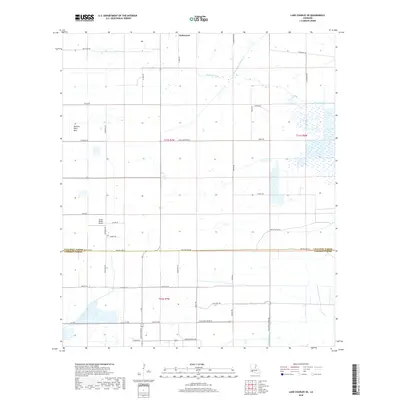
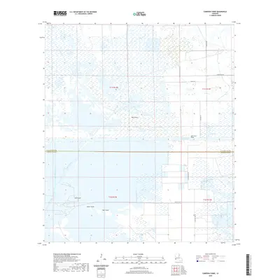
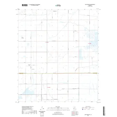
1960 Map of Cameron Farms
USGS Topo · Published 1989About this map
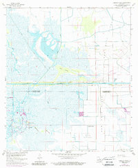
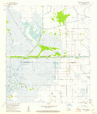
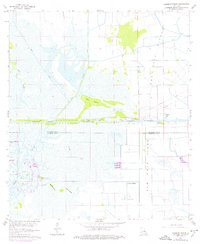
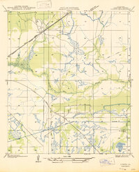
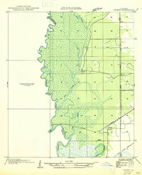
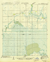
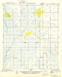
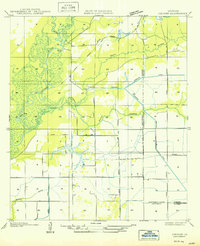
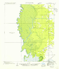
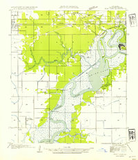
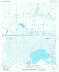
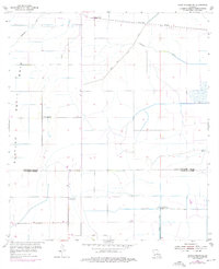
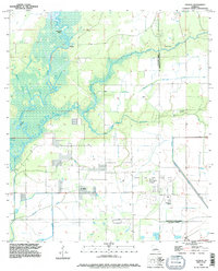
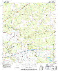
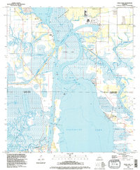
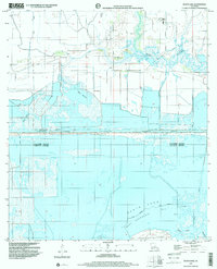
The Intracoastal Waterway cuts a straight path across this coastal landscape, serving as a primary corridor for maritime commerce between Calcasieu and Cameron Parishes. The marshy terrain is defined by a network of drainage systems, including the Vinton Canal, Bancroft Canal, and the Pirogue Canal, which support both agricultural operations and the extraction of natural resources. Industry is concentrated in the southwest and southeast corners of the sheet, where the Black Bayou Oil Field and the Gum Cove Oil and Gas Field reflect the region's mid-century economic focus. Small islands such as Bird Island and Rabbit Island rise from the wetlands near the meandering Black Bayou, while the Gum Cove Ferry provides a critical crossing over the main waterway. This survey captures a moment when large-scale land management at Cameron Farms and localized dredging transformed the natural Wild Prairie into a structured industrial and agricultural zone.
Find a feature on this map
23 named features on this map. Tap any name to fly to it.
Don’t see what you’re looking for? This feature index may not catch every label — zoom into the map to look around manually.
Map Details
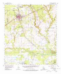
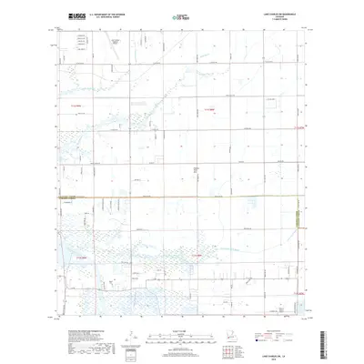
Editions of this 1960 Cameron Farms Map
3 editions found
Historical Maps of Calcasieu Parish Through Time
82 maps found

1932 Lake Charles NE
Calcasieu Parish, LA

1932 Lake Charles NW
Calcasieu Parish, LA

1932 Lake Charles SE
Calcasieu Parish, LA

1932 Lake Charles SW
Calcasieu Parish, LA

1932 Moss Lake
Calcasieu Parish, LA

1935 Buhler
Calcasieu Parish, LA

1946 Moss Lake
Calcasieu Parish, LA

1947 Hecker
Calcasieu Parish, LA
1947 Lunita
Calcasieu Parish, LA

1947 Sulphur Mines
Calcasieu Parish, LA
1947 Toomey
Calcasieu Parish, LA

1947 West Lake
Calcasieu Parish, LA
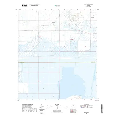
1949 Black Lake
Calcasieu Parish, LA
1949 Cameron Farms
Calcasieu Parish, LA
1950 Hecker
Calcasieu Parish, LA
1954 Toomey
Calcasieu Parish, LA
1954 West Lake
Calcasieu Parish, LA
1955 Black Lake
Calcasieu Parish, LA
1955 Lake Charles SE
Calcasieu Parish, LA
1955 Lake Charles SW
Calcasieu Parish, LA
1955 Moss Lake
Calcasieu Parish, LA
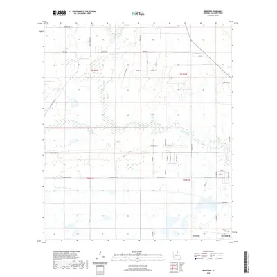
1956 Brimstone
Calcasieu Parish, LA
1956 Buhler
Calcasieu Parish, LA
1956 De Quincy
Calcasieu Parish, LA
1956 De Quincy
Calcasieu Parish, LA
1956 Hecker
Calcasieu Parish, LA
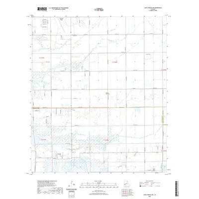
1960 Cameron Farms
Calcasieu Parish, LA
1982 Lunita
Calcasieu Parish, LA
1994 De Quincy
Calcasieu Parish, LA
1994 Hecker
Calcasieu Parish, LA
1994 Lunita
Calcasieu Parish, LA
1994 Moss Lake
Calcasieu Parish, LA
1998 Black Lake
Calcasieu Parish, LA
1998 Brimstone
Calcasieu Parish, LA
1998 Buhler
Calcasieu Parish, LA
1998 Lake Charles SE
Calcasieu Parish, LA
1998 Lake Charles SW
Calcasieu Parish, LA
2012 Black Lake
Calcasieu Parish, LA
2012 Brimstone
Calcasieu Parish, LA
2012 Buhler
Calcasieu Parish, LA
2012 Cameron Farms
Calcasieu Parish, LA
2012 Hecker
Calcasieu Parish, LA
2012 Lake Charles SE
Calcasieu Parish, LA
2012 Lake Charles SW
Calcasieu Parish, LA
2012 Lunita
Calcasieu Parish, LA
2012 Moss Lake
Calcasieu Parish, LA
2015 Black Lake
Calcasieu Parish, LA
2015 Brimstone
Calcasieu Parish, LA
2015 Buhler
Calcasieu Parish, LA
2015 Cameron Farms
Calcasieu Parish, LA
2015 Hecker
Calcasieu Parish, LA
2015 Lake Charles SE
Calcasieu Parish, LA
2015 Lake Charles SW
Calcasieu Parish, LA
2015 Lunita
Calcasieu Parish, LA
2015 Moss Lake
Calcasieu Parish, LA
2018 Black Lake
Calcasieu Parish, LA
2018 Brimstone
Calcasieu Parish, LA
2018 Buhler
Calcasieu Parish, LA
2018 Cameron Farms
Calcasieu Parish, LA
2018 Hecker
Calcasieu Parish, LA
2018 Lake Charles SE
Calcasieu Parish, LA
2018 Lake Charles SW
Calcasieu Parish, LA
2018 Lunita
Calcasieu Parish, LA
2018 Moss Lake
Calcasieu Parish, LA
2020 Black Lake
Calcasieu Parish, LA
2020 Brimstone
Calcasieu Parish, LA
2020 Buhler
Calcasieu Parish, LA
2020 Cameron Farms
Calcasieu Parish, LA

2020 Hecker
Calcasieu Parish, LA
2020 Lake Charles SE
Calcasieu Parish, LA
2020 Lake Charles SW
Calcasieu Parish, LA
2020 Lunita
Calcasieu Parish, LA
2020 Moss Lake
Calcasieu Parish, LA
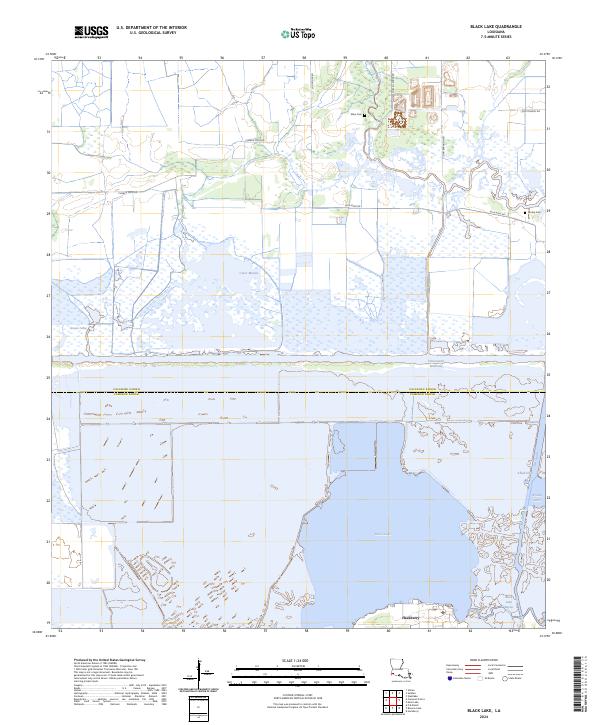
2024 Black Lake
Calcasieu Parish, LA
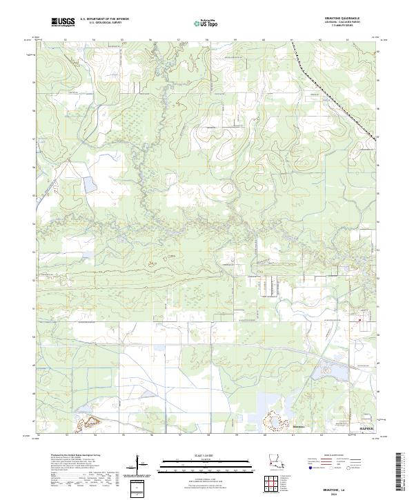
2024 Brimstone
Calcasieu Parish, LA
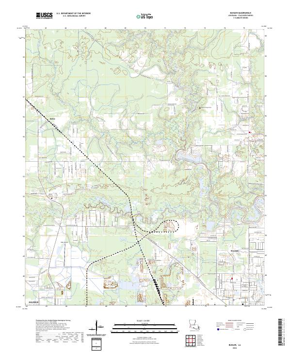
2024 Buhler
Calcasieu Parish, LA
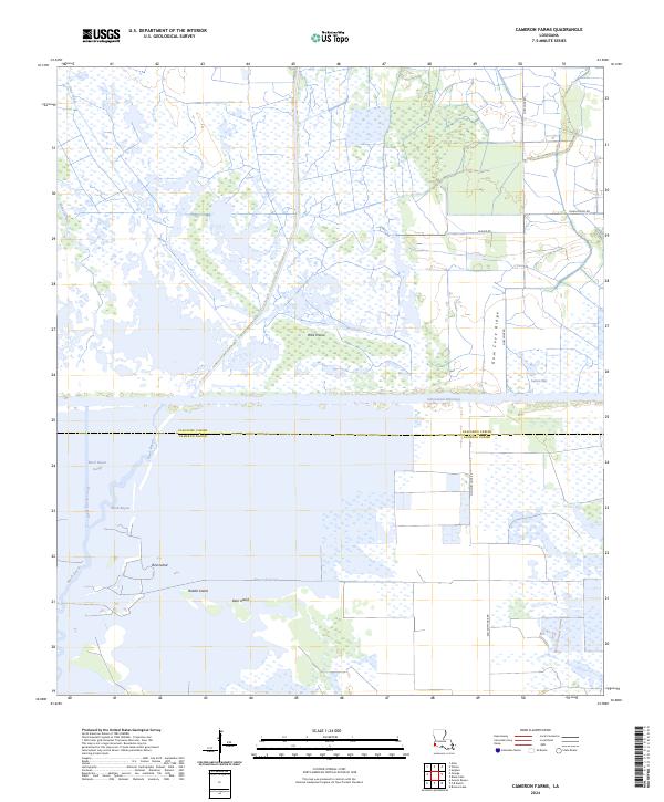
2024 Cameron Farms
Calcasieu Parish, LA
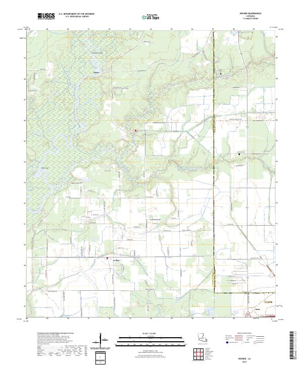
2024 Hecker
Calcasieu Parish, LA
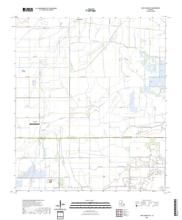
2024 Lake Charles SE
Calcasieu Parish, LA
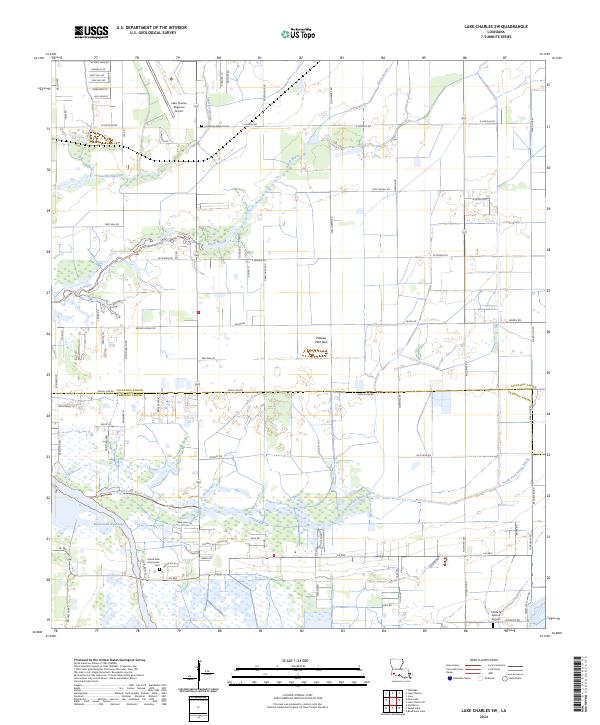
2024 Lake Charles SW
Calcasieu Parish, LA
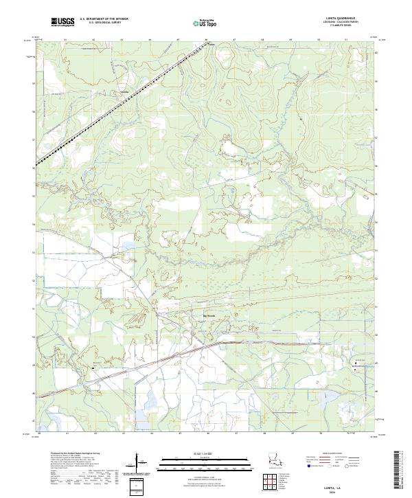
2024 Lunita
Calcasieu Parish, LA
2024 Moss Lake
Calcasieu Parish, LA