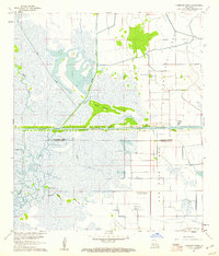
1960 Map of Cameron Farms
USGS Topo · Published 1961About this map
Gum Cove Ridge stands as a prominent topographical feature in this coastal marshland, marking the boundary between Calcasieu and Cameron Parishes during the early 1960s. This survey illustrates a landscape defined by the intersection of industrial development and maritime transit, most notably where the Intracoastal Waterway cuts across the wetlands. The area's economic focus is evident through the Gum Cove Oil and Gas Field and a separate Oil Field to the west, signaling the era's intensive resource extraction.
Find a feature on this map
17 named features on this map. Tap any name to fly to it.
Don’t see what you’re looking for? This feature index may not catch every label — zoom into the map to look around manually.
Map Details
Editions of this 1960 Cameron Farms Map
3 editions found
Other maps of this area

1932 · Orange
USGS Topo · 1:62,500

1934 · Greens Bayou
USGS Topo · 1:24,000

1934 · Browns Lake
USGS Topo · 1:24,000

1934 · Five Lakes
USGS Topo · 1:24,000

1935 · Five Lakes
USGS Topo · 1:31,680

1935 · Browns Lake
USGS Topo · 1:31,680

1935 · Greens Bayou
USGS Topo · 1:31,680

1946 · Phoenix Lake
USGS Topo · 1:31,680

1947 · Sulphur
USGS Topo · 1:31,680

1947 · Vinton
USGS Topo · 1:31,680