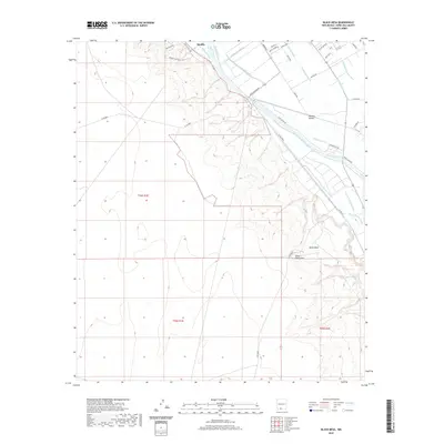
2020 Map of Black Mesa
USGS Topo · Published 2020About this map
The Mesilla Valley defines the eastern portion of this map, where the Rio Grande is flanked by an intricate network of irrigation infrastructure essential to the region's agriculture. This system includes the California Lateral, Alamo Drain, and Mesilla Lateral, showcasing how water management has historically shaped the landscape near Mesilla. To the west, the terrain rises sharply away from the riverbed toward the distinctive volcanic profile of Black Mesa and Santo Tomas Mtn, marking a transition from fertile lowland to high desert.
Find a feature on this map
40 named features on this map. Tap any name to fly to it.
Don’t see what you’re looking for? This feature index may not catch every label — zoom into the map to look around manually.
Map Details
Editions of this 2020 Black Mesa Map
This is the sole edition of this map. No revisions or reprints were ever made.
Other maps of this area

1891 · Las Cruces
USGS Topo · 1:125,000

1893 · Las Cruces
USGS Topo · 1:125,000

1941 · Las Cruces
USGS Topo · 1:62,500

1941 · Organ Peak
USGS Topo · 1:62,500

1943 · La Mesa
USGS Topo · 1:62,500

1943 · Organ Peak
USGS Topo · 1:62,500

1943 · Afton
USGS Topo · 1:62,500

1943 · Las Cruces
USGS Topo · 1:62,500
1955 · Tortugas Mountain
USGS Topo · 1:24,000
1955 · San Miguel
USGS Topo · 1:24,000