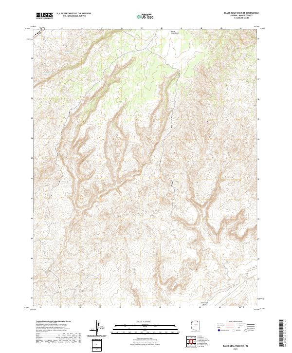
2021 Map of Black Mesa Wash NE
USGS Topo · Published 2021About this map
Black Mesa Wash winds through the high-elevation landscape of Navajo County, defining the drainage patterns of this arid plateau. This 2021 topographic survey captures a territory largely devoid of modern development, instead emphasizing the natural hydrography and elevation contours that have long dictated human movement and settlement in the region. To the north, Sand Spring and Peach Spring represent critical water sources in a complex terrain of mesas and drainages. The southern portion of the sheet is dominated by the broad course of Moenkopi Wash, a significant tributary system. The map provides a precise layout of the Public Land Survey System, including t36n r16e and t34n r17e, which are essential for researchers tracing property boundaries or grazing allotments across this section of the Arizona landscape.
Find a feature on this map
10 named features on this map. Tap any name to fly to it.
Don’t see what you’re looking for? This feature index may not catch every label — zoom into the map to look around manually.
Map Details
Editions of this 2021 Black Mesa Wash NE Map
This is the sole edition of this map. No revisions or reprints were ever made.
Other maps of this area

1883 · Marsh Pass
USGS Topo · 1:250,000

1892 · Marsh Pass
USGS Topo · 1:250,000

1956 · Marble Canyon
USGS Topo · 1:250,000

1959 · Marble Canyon
USGS Topo · 1:250,000

1961 · Marble Canyon
USGS Topo · 1:250,000
1968 · Owl Valley
USGS Topo · 1:24,000
1970 · Kydestea Spring
USGS Topo · 1:24,000

1970 · Black Mesa Wash NW
USGS Topo · 1:24,000

1970 · Shonto SE
USGS Topo · 1:24,000
1970 · Shonto
USGS Topo · 1:24,000