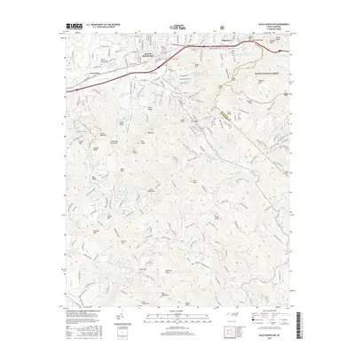
2016 Map of Black Mountain
USGS Topo · Published 2016About this map
Black Mountain and Ridgecrest anchor this high-elevation landscape at the eastern edge of the Blue Ridge, where the Swannanoa River begins its descent. The map highlights a critical mountain corridor defined by the Swannanoa Gap and the subterranean passage of the Swannanoa Tunnel, infrastructure essential for crossing the divide between Buncombe Co and Mcdowell Co. Modern institutional landmarks like the Western Carolina State Veterans Cem and Camp Ridgecrest sit alongside older terrain features such as Highland Farm. To the south, the terrain steepens into the Pisgah National Forest, where the headwaters of the Catawba River emerge at Catawba Falls Preserve. This survey documents a transition from the town's developed areas and recreational waters like Lake Tomahawk to the high ridges of Kitsuma Peak and Little Pisgah Mtn.
Find a feature on this map
156 named features on this map. Tap any name to fly to it.
Don’t see what you’re looking for? This feature index may not catch every label — zoom into the map to look around manually.
Map Details
Editions of this 2016 Black Mountain Map
This is the sole edition of this map. No revisions or reprints were ever made.
Other maps of this area

1900 · Mount Mitchell
USGS Topo · 1:125,000

1902 · Mount Mitchell
USGS Topo · 1:125,000

1907 · Saluda
USGS Topo · 1:125,000

1934 · Parts Of Old Fort and Montreat
USGS Topo · 1:24,000

1935 · Montreat
USGS Topo · 1:24,000

1935 · Batcave
USGS Topo · 1:24,000

1935 · Black Mountain
USGS Topo · 1:24,000

1935 · Craggy Pinnacle
USGS Topo · 1:24,000

1936 · Fruitland
USGS Topo · 1:24,000

1941 · Black Mountain
USGS Topo · 1:24,000