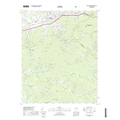
2019 Map of Black Mountain
USGS Topo · Published 2019About this map
The town of Black Mountain sits at a critical geographic junction where the Swannanoa River begins its descent toward the French Broad. This modern survey illustrates the complex human engineering required to traverse the Blue Ridge mountains, most notably at the Swannanoa Gap. Here, the Norfolk Southern railroad passes through the Swannanoa Tunnel, a historic engineering feat that connects the Atlantic-facing Piedmont to the Tennessee Valley drainage.
Find a feature on this map
247 named features on this map. Tap any name to fly to it.
Don’t see what you’re looking for? This feature index may not catch every label — zoom into the map to look around manually.
Map Details
Editions of this 2019 Black Mountain Map
This is the sole edition of this map. No revisions or reprints were ever made.
Other maps of this area

1900 · Mount Mitchell
USGS Topo · 1:125,000

1902 · Mount Mitchell
USGS Topo · 1:125,000

1907 · Saluda
USGS Topo · 1:125,000

1934 · Parts Of Old Fort and Montreat
USGS Topo · 1:24,000

1935 · Montreat
USGS Topo · 1:24,000

1935 · Batcave
USGS Topo · 1:24,000

1935 · Black Mountain
USGS Topo · 1:24,000

1935 · Craggy Pinnacle
USGS Topo · 1:24,000

1936 · Fruitland
USGS Topo · 1:24,000

1941 · Black Mountain
USGS Topo · 1:24,000