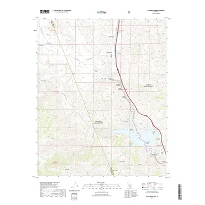
2018 Map of Black Mountain
USGS Topo · Published 2018About this map
Pyramid Lake sits at the heart of this landscape, its waters surrounded by the high terrain of the Angeles National Forest and Los Padres National Forest. The engineering of the California State Water Project is visible through the Governor Edmund G Brown W Br California Aqueduct and the Angeles Tunnel, reflecting modern infrastructure in this mountainous corridor. The settlement of Caswell lies near the northern edge, situated along the transportation route defined by Gorman Post Rd and the interstate. High peaks like Black Mtn, White Mtn, and Slide Mtn define the topography, while numerous water sources such as Beartrap Spring and Royball Spring indicate the critical hydrology of the canyons. The boundary between Ventura Co and Los Angeles Co cuts through the western portion of the survey, tracing the ridge lines above Hungry Valley.
Find a feature on this map
54 named features on this map. Tap any name to fly to it.
Don’t see what you’re looking for? This feature index may not catch every label — zoom into the map to look around manually.
Map Details
Editions of this 2018 Black Mountain Map
This is the sole edition of this map. No revisions or reprints were ever made.
Other maps of this area

1903 · Tejon
USGS Topo · 1:125,000

1932 · Beartrap Canyon
USGS Topo · 1:24,000

1933 · Quail
USGS Topo · 1:24,000

1933 · Gorman
USGS Topo · 1:24,000

1938 · Beartrap Canyon
USGS Topo · 1:24,000

1938 · Gorman
USGS Topo · 1:24,000

1938 · Black Mountain
USGS Topo · 1:24,000

1938 · Quail
USGS Topo · 1:24,000

1942 · Frazier Mountain
USGS Topo · 1:24,000

1943 · Neenach
USGS Topo · 1:62,500