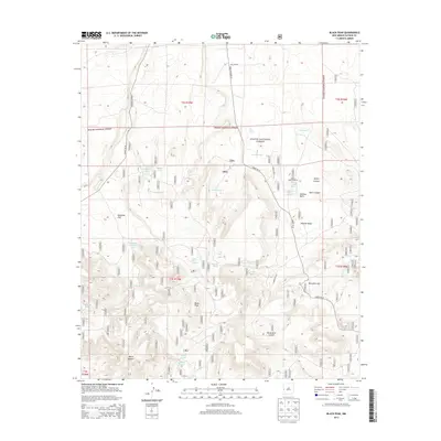
2013 Map of Black Peak
USGS Topo · Published 2013About this map
The high-elevation landscape of the Apache National Forest is defined here by a complex network of water sources and canyons within the New Mexico backcountry. Black Peak serves as a central landmark, overlooking a terrain punctuated by essential ranching and survival features such as the Johnson Basin Windmill and Mangitas Storage Tank. The area's hydrology is remarkably detailed, tracing numerous natural outlets like Higgs Spring, Malpais Spring, and Dripping Spring, which sustained life in this arid environment. Significant topographic transitions occur at Harcaslte Gap and across Mangitas Flat, while the erosion patterns of Hardcastle Canyon and Water Canyon illustrate the geological forces shaping Catron County. The prevalence of named tanks and springs highlights the historic reliance on seasonal water management for both wildlife and livestock throughout this section of the national forest.
Find a feature on this map
46 named features on this map. Tap any name to fly to it.
Don’t see what you’re looking for? This feature index may not catch every label — zoom into the map to look around manually.
Map Details
Editions of this 2013 Black Peak Map
This is the sole edition of this map. No revisions or reprints were ever made.
Other maps of this area

1915 · Reserve
USGS Topo · 1:125,000

1918 · Reserve
USGS Topo · 1:125,000

1954 · Clifton
USGS Topo · 1:250,000

1954 · Saint Johns
USGS Topo · 1:250,000

1955 · Red Hill
USGS Topo · 1:24,000

1957 · Clifton
USGS Topo · 1:250,000

1957 · Saint Johns
USGS Topo · 1:250,000

1958 · Clifton
USGS Topo · 1:250,000

1958 · Saint Johns
USGS Topo · 1:250,000

1962 · Clifton
USGS Topo · 1:250,000