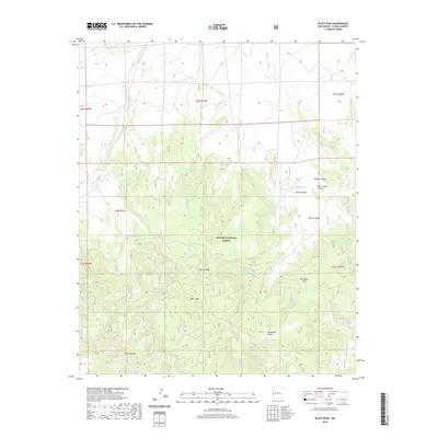
2020 Map of Black Peak
USGS Topo · Published 2020About this map
Black Peak anchors this corner of the Apache National Forest in New Mexico, where the high-desert landscape is defined by its vital water sources and dramatic elevation changes. The distribution of features like White Bluff Spring, Dripping Spring, and Malpais Spring indicates the critical role of groundwater for survival and land use in Catron County. The topography is marked by significant drainages and level clearings such as Mangitas Flat, which contrast with the steep descents into Water Canyon and Hardcastle Canyon. This modern survey illustrates the enduring nature of named landmarks in the American Southwest, from Harcastle Gap to the expansive Johnson Basin. Small-scale cattle or wildlife management is evident through the inclusion of man-made tanks like Harrys Tank and Gully Tank, which support life across this high country.
Find a feature on this map
30 named features on this map. Tap any name to fly to it.
Don’t see what you’re looking for? This feature index may not catch every label — zoom into the map to look around manually.
Map Details
Editions of this 2020 Black Peak Map
This is the sole edition of this map. No revisions or reprints were ever made.
Other maps of this area

1915 · Reserve
USGS Topo · 1:125,000

1918 · Reserve
USGS Topo · 1:125,000

1954 · Clifton
USGS Topo · 1:250,000

1954 · Saint Johns
USGS Topo · 1:250,000

1955 · Red Hill
USGS Topo · 1:24,000

1957 · Clifton
USGS Topo · 1:250,000

1957 · Saint Johns
USGS Topo · 1:250,000

1958 · Clifton
USGS Topo · 1:250,000

1958 · Saint Johns
USGS Topo · 1:250,000

1962 · Clifton
USGS Topo · 1:250,000