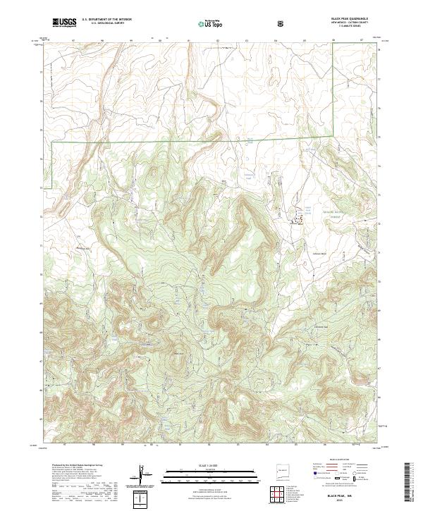
2023 Map of Black Peak
USGS Topo · Published 2023About this map
Apache National Forest encompasses this high-altitude reach of New Mexico, dominated by the prominent summit of Black Peak. The landscape is a network of named drainages and basins, including Johnson Basin, Renfro Canyon, and Hardcastle Canyon, which cut through the elevated terrain. The water distribution pattern is highly specialized, consisting of numerous livestock tanks and natural springs such as White Bluff Spring, Dripping Spring, and Hardcastle Spring. These features suggest a landscape managed for range use, where seasonal water sources are vital to local activity. The presence of Mangitas Flat and Harcastle Gap provides topographical context to the movement through these canyons. This 2023 survey serves as a detailed record of water rights and geographic nomenclature in a sparsely settled but carefully named portion of Catron County.
Find a feature on this map
35 named features on this map. Tap any name to fly to it.
Don’t see what you’re looking for? This feature index may not catch every label — zoom into the map to look around manually.
Map Details
Editions of this 2023 Black Peak Map
This is the sole edition of this map. No revisions or reprints were ever made.
Other maps of this area

1915 · Reserve
USGS Topo · 1:125,000

1918 · Reserve
USGS Topo · 1:125,000

1954 · Clifton
USGS Topo · 1:250,000

1954 · Saint Johns
USGS Topo · 1:250,000

1955 · Red Hill
USGS Topo · 1:24,000

1957 · Clifton
USGS Topo · 1:250,000

1957 · Saint Johns
USGS Topo · 1:250,000

1958 · Clifton
USGS Topo · 1:250,000

1958 · Saint Johns
USGS Topo · 1:250,000

1962 · Clifton
USGS Topo · 1:250,000