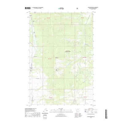
2020 Map of Black Pine Ridge
USGS Topo · Published 2020About this map
The John Long Mountains define the high country of this Granite County landscape, where the Deerlodge National Forest encompasses the majority of the terrain. The topography is dominated by a complex network of drainage basins, most notably the waters of Upper Willow Creek and its many tributaries. Historic land use is evidenced by the numerous named gulches that score the mountain slopes, including Alder Gulch, Arbuckle Gulch, and Slussers Gulch, names often associated with early Montana prospecting and resource extraction. At the center of the sheet, the namesake Black Pine Ridge stands between Long John Creek and the South Fork Lower Willow Creek. While largely a roadless wilderness area, the map shows human presence through the Willow Airport on the western edge and a handful of forest routes like Black Pine Road and Willow Creek Road.
Find a feature on this map
31 named features on this map. Tap any name to fly to it.
Don’t see what you’re looking for? This feature index may not catch every label — zoom into the map to look around manually.
Map Details
Editions of this 2020 Black Pine Ridge Map
This is the sole edition of this map. No revisions or reprints were ever made.
Other maps of this area

1903 · Bonner
USGS Topo · 1:125,000

1908 · Philipsburg
USGS Topo · 1:125,000

1909 · Sapphire
USGS Topo · 1:125,000

1919 · Drummond
USGS Topo · 1:125,000

1921 · Drummond
USGS Topo · 1:125,000

1947 · Butte
USGS Topo · 1:250,000

1958 · Butte
USGS Topo · 1:250,000

1959 · Bearmouth
USGS Topo · 1:62,500

1959 · Ravenna
USGS Topo · 1:62,500

1960 · Butte
USGS Topo · 1:250,000