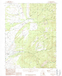
1987 Map of Black Ridge
USGS Topo · Published 1987About this map
The town of Beaver serves as the focal point of this 1980s-era survey, where the valley's agricultural infrastructure meets the rising elevations of the Fishlake National Forest. A complex network of irrigation systems, including the South Field DITCH, Willis Ditch, and Harris Ditch, reveals the vital importance of water management for the high-desert landscape. The terrain shifts from the flat Table Grounds and Last Chance Bench into the significant verticality of Black Ridge and Black Mountain.
Find a feature on this map
49 named features on this map. Tap any name to fly to it.
Don’t see what you’re looking for? This feature index may not catch every label — zoom into the map to look around manually.
Map Details
Editions of this 1987 Black Ridge Map
This is the sole edition of this map. No revisions or reprints were ever made.
Other maps of this area

1885 · Beaver
USGS Topo · 1:250,000

1937 · Delano Peak
USGS Topo · 1:48,000

1943 · Delano Peak
USGS Topo · 1:62,500

1953 · Richfield
USGS Topo · 1:250,000

1954 · Beaver SE
USGS Topo · 1:24,000

1954 · Beaver NE
USGS Topo · 1:24,000

1958 · Richfield
USGS Topo · 1:250,000

1958 · Beaver
USGS Topo · 1:62,500
1971 · Kane Canyon
USGS Topo · 1:24,000
1971 · Greenville Bench
USGS Topo · 1:24,000