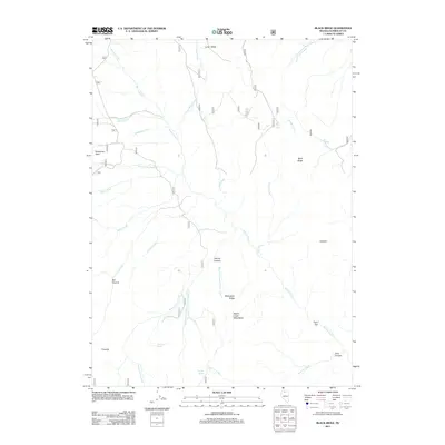
2011 Map of Black Ridge
USGS Topo · Published 2011About this map
Martin Creek and its many tributaries, including Dutch John Creek and Bradshaw Creek, carve through this high-elevation landscape in Humboldt County. The terrain is defined by prominent elevations such as Mahogany Ridge and the Martin Creek Mountains, while the drainage system of Long Valley Creek feeds into the northern reaches of the quadrangle. Human presence is concentrated near Cloister and the landing strip at Bradshaw Field, reflecting the sparse ranching and aviation footprint of this Nevada high desert region. Vital water sources for livestock and local wildlife are documented through various named points like Recanzone Spring, Coal Pit Spring, and East Spring. The map also details distinct geological and topographic markers, from the depths of Harvey Canyon and Box Canyon to the notable peak at Thimble.
Find a feature on this map
30 named features on this map. Tap any name to fly to it.
Don’t see what you’re looking for? This feature index may not catch every label — zoom into the map to look around manually.
Map Details
Editions of this 2011 Black Ridge Map
This is the sole edition of this map. No revisions or reprints were ever made.
Other maps of this area

1882 · Paradise
USGS Topo · 1:250,000

1893 · Paradise
USGS Topo · 1:250,000

1955 · McDermitt
USGS Topo · 1:250,000

1959 · McDermitt
USGS Topo · 1:250,000

1959 · McDermitt
USGS Topo · 1:62,500

1959 · Hinkey Summit
USGS Topo · 1:62,500

1980 · Capitol Peak
USGS Topo · 1:24,000

1980 · Black Ridge
USGS Topo · 1:24,000

1980 · Hardscrabble
USGS Topo · 1:24,000

1980 · Spring City
USGS Topo · 1:24,000