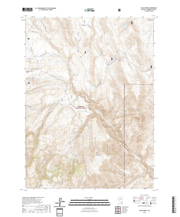
2021 Map of Black Ridge
USGS Topo · Published 2021About this map
Humboldt National Forest encompasses the high-desert terrain of the Martin Creek Mountains, where steep ridges and deep drainage systems define the landscape of northern Nevada. This 2021 survey shows a network of Forest Service roads and trails, including the Round Corral Road and the New Motortrail Trl, providing access to remote locations like Bradshaw Field and Cloister. Water sources are vital features in this arid environment, evidenced by named points like Recanzone Spring, Coal Pit Spring, and the headwaters of the N Fork Little Humboldt. Significant elevation changes are marked by Mahogany Ridge and Black Ridge, while deep cuts like Harvey Canyon and Box Canyon channel seasonal runoff from the higher peaks near Hinkey Summit.
Find a feature on this map
49 named features on this map. Tap any name to fly to it.
Don’t see what you’re looking for? This feature index may not catch every label — zoom into the map to look around manually.
Map Details
Editions of this 2021 Black Ridge Map
This is the sole edition of this map. No revisions or reprints were ever made.
Other maps of this area

1882 · Paradise
USGS Topo · 1:250,000

1893 · Paradise
USGS Topo · 1:250,000

1955 · McDermitt
USGS Topo · 1:250,000

1959 · McDermitt
USGS Topo · 1:250,000

1959 · McDermitt
USGS Topo · 1:62,500

1959 · Hinkey Summit
USGS Topo · 1:62,500

1980 · Capitol Peak
USGS Topo · 1:24,000

1980 · Black Ridge
USGS Topo · 1:24,000

1980 · Hardscrabble
USGS Topo · 1:24,000

1980 · Spring City
USGS Topo · 1:24,000