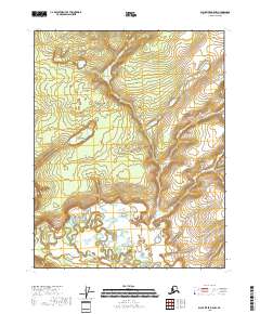
2018 Map of Black River B-5 NW
USGS Topo · Published 2018About this map
The Little Black River winds through this interior Alaskan landscape, characterized by complex oxbow lakes and vast wetland systems in the Yukon-Koyukuk Census Area. The terrain is largely dominated by the low-lying fluvial features of the river basin, with Bearnose Hill providing a distinct topographic rise in the northwestern portion of the quadrangle. Surveyed by the U.S. Geological Survey using imagery from 2009 and 2010, the map illustrates the intricate drainage patterns where the river loops back upon itself, creating a series of unnamed ponds and marshes. This map provides a clear record of the shifting river channels and hydrology of the Black River region within townships t19n r20e, t19n r21e, t18n r20e, and t18n r21e.
Find a feature on this map
6 named features on this map. Tap any name to fly to it.
Don’t see what you’re looking for? This feature index may not catch every label — zoom into the map to look around manually.
Map Details
Editions of this 2018 Black River B-5 NW Map
This is the sole edition of this map. No revisions or reprints were ever made.
Other maps of this area

1951 · Black River
USGS Topo · 1:250,000

1956 · Black River B-6
USGS Topo · 1:63,360

1956 · Black River B-5
USGS Topo · 1:63,360

1956 · Black River C-6
USGS Topo · 1:63,360

1956 · Black River C-5
USGS Topo · 1:63,360

1956 · Black River
USGS Topo · 1:250,000

1964 · Black River
USGS Topo · 1:250,000
2018 · Black River B-5 NE
USGS Topo · 1:25,000
2018 · Black River C-6 SE
USGS Topo · 1:25,000
2018 · Black River B-5 SE
USGS Topo · 1:25,000