
1956 Map of Black River B-5
USGS Topo · Published 1959About this map
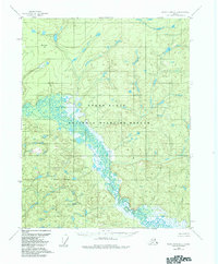
Tohulkade Lake anchors a complex network of wetlands and wandering waterways in this mid-1950s interior Alaskan landscape. The terrain is defined by dense contouring that rises toward Bearnose Hill in the northwest, contrasting with the low-lying marshlands that dominate the central and southeastern portions of the sheet. Aerial photographs from 1955 reveal a wilderness of intricate oxbows and unnamed ponds, illustrating the natural hydrological processes of the Yukon-Koyukuk region before significant modern development. The map reflects a period when the Geological Survey was systematically documenting the more remote reaches of the territory, relying on photogrammetric methods to capture the labyrinthine drainage patterns of the Black River basin.
Find a feature on this map
2 named features on this map. Tap any name to fly to it.
Don’t see what you’re looking for? This feature index may not catch every label — zoom into the map to look around manually.
Map Details
Editions of this 1956 Black River B-5 Map
2 editions found
Other maps of this area

1951 · Black River
USGS Topo · 1:250,000

1956 · Black River B-6
USGS Topo · 1:63,360

1956 · Black River A-4
USGS Topo · 1:63,360

1956 · Black River C-6
USGS Topo · 1:63,360

1956 · Black River B-4
USGS Topo · 1:63,360

1956 · Black River C-5
USGS Topo · 1:63,360

1956 · Black River C-4
USGS Topo · 1:63,360

1956 · Black River A-6
USGS Topo · 1:63,360
1956 · Black River A-5
USGS Topo · 1:63,360

1956 · Black River
USGS Topo · 1:250,000