
1956 Map of Black River A-4
USGS Topo · Published 1959About this map
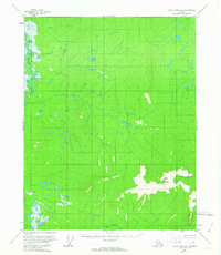
The northern Yukon-Koyukuk region is defined here by the winding course of the Little Black River, which cuts through a dense landscape of wetlands and small lakes. Surveyed in the mid-1950s using photogrammetric methods, the terrain rises from these low-lying water bodies toward the prominence of Bear Mountain in the southeast. Drainage from these heights flows via Bear Mountain Creek toward the river system. The absence of roads or established trails throughout this quadrangle reflects the isolated character of the Alaskan interior during this period, where the natural hydrography and high-altitude survey points like the VABM station served as the primary landmarks for navigation and mapping.
Find a feature on this map
3 named features on this map. Tap any name to fly to it.
Don’t see what you’re looking for? This feature index may not catch every label — zoom into the map to look around manually.
Map Details
Editions of this 1956 Black River A-4 Map
2 editions found
Other maps of this area

1951 · Charley River
USGS Topo · 1:250,000

1951 · Black River
USGS Topo · 1:250,000

1956 · Black River B-5
USGS Topo · 1:63,360

1956 · Black River B-3
USGS Topo · 1:63,360

1956 · Black River A-3
USGS Topo · 1:63,360

1956 · Black River B-4
USGS Topo · 1:63,360
1956 · Black River A-5
USGS Topo · 1:63,360
1956 · Charley River D-4
USGS Topo · 1:63,360
1956 · Charley River D-5
USGS Topo · 1:63,360

1956 · Charley River D-3
USGS Topo · 1:63,360