
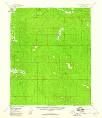
1956 Map of Black River A-3
USGS Topo · Published 1959About this map
Black River and its intricate tributaries dominate this mid-century Alaskan interior landscape, characterized by an expansive network of wetlands and meandering waterways. The Grayling Fork Black River joins the main branch amidst a labyrinth of oxbow lakes and marshes, signifying the complex drainage patterns of the Yukon-Koyukuk region. In a landscape nearly devoid of permanent infrastructure, the presence of Cabins along the riverbanks suggests the vital role of these watercourses for seasonal transit, trapping, or subsistence activities during the 1950s.
Find a feature on this map
10 named features on this map. Tap any name to fly to it.
Don’t see what you’re looking for? This feature index may not catch every label — zoom into the map to look around manually.
Map Details
Editions of this 1956 Black River A-3 Map
This is the sole edition of this map. No revisions or reprints were ever made.
Other maps of this area

1951 · Charley River
USGS Topo · 1:250,000

1951 · Black River
USGS Topo · 1:250,000

1956 · Black River A-2
USGS Topo · 1:63,360

1956 · Black River A-4
USGS Topo · 1:63,360

1956 · Black River B-3
USGS Topo · 1:63,360

1956 · Black River B-2
USGS Topo · 1:63,360

1956 · Black River B-4
USGS Topo · 1:63,360
1956 · Charley River D-4
USGS Topo · 1:63,360

1956 · Charley River D-3
USGS Topo · 1:63,360

1956 · Black River
USGS Topo · 1:250,000