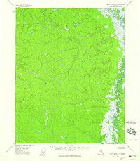
1956 Map of Black River A-5
USGS Topo · Published 1959About this map
The Little Black River winds through this interior Alaskan landscape, defining the eastern edge of a territory marked by complex hydrological patterns and countless unnamed small lakes and ponds. Based on 1955 aerial photography and 1956 field annotation, this survey captures a remote subarctic environment devoid of established roads or named settlements during the mid-1950s. The terrain is characterized by a dense network of drainages and elevations that suggest a land dominated by seasonal water movement and permafrost features. Researchers interested in the historical geography of the Yukon-Koyukuk region can trace the intricate meanders and oxbows of the Little Black River as they appeared before modern environmental shifts, providing a baseline for understanding this undisturbed wilderness.
Find a feature on this map
1 named feature on this map. Tap any name to fly to it.
Don’t see what you’re looking for? This feature index may not catch every label — zoom into the map to look around manually.
Map Details
Editions of this 1956 Black River A-5 Map
2 editions found
Other maps of this area

1951 · Charley River
USGS Topo · 1:250,000

1951 · Black River
USGS Topo · 1:250,000

1956 · Black River B-6
USGS Topo · 1:63,360

1956 · Black River A-4
USGS Topo · 1:63,360

1956 · Black River B-5
USGS Topo · 1:63,360

1956 · Black River B-4
USGS Topo · 1:63,360

1956 · Black River A-6
USGS Topo · 1:63,360
1956 · Charley River D-4
USGS Topo · 1:63,360
1956 · Charley River D-5
USGS Topo · 1:63,360

1956 · Black River
USGS Topo · 1:250,000