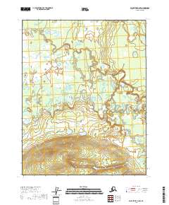
2018 Map of Black River B-6 NW
USGS Topo · Published 2018About this map
Grass River and the Sucker River dominate this interior landscape in the Yukon-Koyukuk region, illustrating a complex network of meandering waterways and wetlands. The terrain is characterized by intricate oxbow formations and low-lying marshes, typical of the subarctic river systems that define this part of the Alaska wilderness. Small tributaries like Big Cr feed into these larger arteries, while the Little Black River touches the eastern edge of the survey area. There are no roads or permanent settlements indicated, reflecting a landscape shaped almost entirely by natural hydrologic processes. This 2018 survey serves as a modern record of these shifting river channels before any significant human development or infrastructure changed the drainage patterns of the basin.
Find a feature on this map
9 named features on this map. Tap any name to fly to it.
Don’t see what you’re looking for? This feature index may not catch every label — zoom into the map to look around manually.
Map Details
Editions of this 2018 Black River B-6 NW Map
This is the sole edition of this map. No revisions or reprints were ever made.
Other maps of this area

1951 · Fort Yukon
USGS Topo · 1:250,000

1951 · Black River
USGS Topo · 1:250,000

1956 · Fort Yukon C-1
USGS Topo · 1:63,360

1956 · Black River B-6
USGS Topo · 1:63,360

1956 · Black River C-6
USGS Topo · 1:63,360

1956 · Fort Yukon B-1
USGS Topo · 1:63,360

1956 · Fort Yukon
USGS Topo · 1:250,000

1956 · Black River
USGS Topo · 1:250,000

1964 · Black River
USGS Topo · 1:250,000
2018 · Black River C-6 SE
USGS Topo · 1:25,000