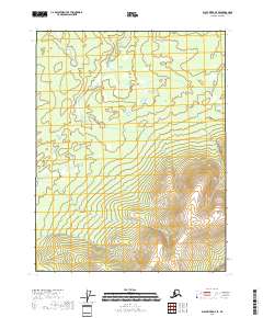
2018 Map of Black River D-4 SE
USGS Topo · Published 2018About this map
Tl'oo Hanshyah Mtn dominates the southeastern terrain of this high-latitude landscape, its contours rising sharply above the surrounding wetlands and creek beds. Located in the Yukon-Koyukuk Census Area, the map illustrates the vast, unpopulated character of the Alaskan interior where the Public Land Survey System grid serves as the primary reference for navigation. Surveyed in 2018, the quadrangle includes the intersection of multiple township and range lines, such as t23n r23e and t23n r24e, reflecting the systematic mapping of this remote region. The drainage patterns and small alpine lakes throughout the northern half of the sheet reveal the intricate hydrology that defines the foothills before they ascend toward more prominent peaks.
Find a feature on this map
7 named features on this map. Tap any name to fly to it.
Don’t see what you’re looking for? This feature index may not catch every label — zoom into the map to look around manually.
Map Details
Editions of this 2018 Black River D-4 SE Map
This is the sole edition of this map. No revisions or reprints were ever made.
Other maps of this area

1951 · Black River
USGS Topo · 1:250,000

1956 · Black River D-3
USGS Topo · 1:63,360

1956 · Black River D-4
USGS Topo · 1:63,360

1956 · Black River C-4
USGS Topo · 1:63,360

1956 · Black River C-3
USGS Topo · 1:63,360

1956 · Black River
USGS Topo · 1:250,000

1964 · Black River
USGS Topo · 1:250,000
2018 · Black River C-3 NW
USGS Topo · 1:25,000
2018 · Black River C-4 NE
USGS Topo · 1:25,000
2018 · Black River D-3 SW
USGS Topo · 1:25,000