
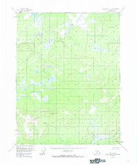
1956 Map of Black River D-3
USGS Topo · Published 1959About this map
The interior of the Yukon-Koyukuk region is defined by an intricate network of waterways and high terrain in this mid-1950s survey. Dominating the southern landscape is Niggerhead Mountain, providing a stark contrast to the sprawling wetlands and small lakes that characterize the northern and central sections. This survey, completed without direct field checking and relying on 1955 aerial photography, reveals a remote wilderness devoid of established roads or permanent settlements at the time. Hydrological features such as Rat Creek in the northwest and David Creek in the northeast illustrate the natural drainage patterns of the area, while Kevinjik Creek meanders through the southeast. The map serves as a primary record of the topographic state of this Alaskan interior before significant modern change, showing the land as it was navigated by indigenous residents and occasional explorers during the mid-twentieth century.
Find a feature on this map
4 named features on this map. Tap any name to fly to it.
Don’t see what you’re looking for? This feature index may not catch every label — zoom into the map to look around manually.
Map Details
Editions of this 1956 Black River D-3 Map
2 editions found
Other maps of this area

1951 · Black River
USGS Topo · 1:250,000

1951 · Coleen
USGS Topo · 1:250,000

1956 · Coleen
USGS Topo · 1:250,000

1956 · Black River D-4
USGS Topo · 1:63,360

1956 · Coleen A-3
USGS Topo · 1:63,360

1956 · Black River C-2
USGS Topo · 1:63,360

1956 · Black River D-2
USGS Topo · 1:63,360

1956 · Black River C-4
USGS Topo · 1:63,360

1956 · Coleen A-4
USGS Topo · 1:63,360

1956 · Black River C-3
USGS Topo · 1:63,360