
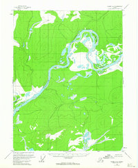
1956 Map of Coleen A-3
USGS Topo · Published 1959About this map
The Porcupine River dominates this mid-century subarctic landscape, carving a wide path through the Yukon-Koyukuk region. In the north, the river takes a sharp, distinctive turn at Fishhook Bend, encircling Henry Martin Island. Evidence of human presence in this remote interior is sparse, marked primarily by isolated structures like Curtis Cabin and another unnamed Cabin located near the northern river bend. These outposts, along with the junction of the Coleen River and Fish Creek, represent the essential landmarks for navigation and survival in the era before modern development. The mapping relies on a series of vertical angle benchmarks, including VABM 1377 Bend and VABM Wheel 723, to define the elevations of the surrounding highlands above the alluvial plains.
Find a feature on this map
11 named features on this map. Tap any name to fly to it.
Don’t see what you’re looking for? This feature index may not catch every label — zoom into the map to look around manually.
Map Details
Editions of this 1956 Coleen A-3 Map
2 editions found
Other maps of this area

1951 · Black River
USGS Topo · 1:250,000

1951 · Coleen
USGS Topo · 1:250,000

1956 · Coleen
USGS Topo · 1:250,000

1956 · Coleen B-2
USGS Topo · 1:63,360

1956 · Black River D-3
USGS Topo · 1:63,360

1956 · Black River D-4
USGS Topo · 1:63,360

1956 · Black River D-2
USGS Topo · 1:63,360

1956 · Coleen A-4
USGS Topo · 1:63,360

1956 · Coleen A-2
USGS Topo · 1:63,360

1956 · Black River
USGS Topo · 1:250,000