
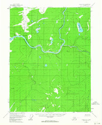
1956 Map of Coleen A-2
USGS Topo · Published 1959About this map
The Porcupine River carves a winding path through this northern interior landscape, meeting the Salmon Trout River at a sharp bend near Old Rampart. This 1950s survey documents a critical wilderness corridor during the mid-century era of aerial photogrammetry, capturing established locations like Old Camp and the geological formation simply labeled Canyon.
Find a feature on this map
12 named features on this map. Tap any name to fly to it.
Don’t see what you’re looking for? This feature index may not catch every label — zoom into the map to look around manually.
Map Details
Editions of this 1956 Coleen A-2 Map
3 editions found
Other maps of this area

1951 · Black River
USGS Topo · 1:250,000

1951 · Coleen
USGS Topo · 1:250,000

1956 · Coleen
USGS Topo · 1:250,000

1956 · Coleen B-2
USGS Topo · 1:63,360
1956 · Coleen B-1
USGS Topo · 1:63,360

1956 · Black River D-3
USGS Topo · 1:63,360

1956 · Coleen A-1
USGS Topo · 1:63,360

1956 · Coleen A-3
USGS Topo · 1:63,360

1956 · Black River D-2
USGS Topo · 1:63,360
1956 · Black River D-1
USGS Topo · 1:63,360